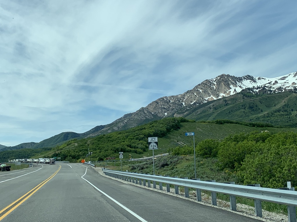
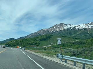
I'm baaaack! It's been a long time, but I've finally had the time to write up a new post. Today, I'll be discussing the history of the Trappers Loop highway in northern Utah and the roads connecting to the nearby Snowbasin ski area. Snowbasin is located in the snow-covered mountains in the background of the photo below, which was taken from southbound Trappers Loop Road (SR 167):
 |
| One of my all-time favorite road photos. |
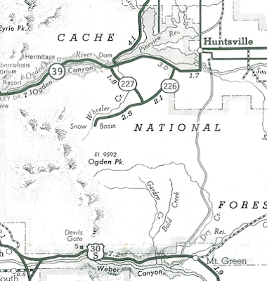
However, to start off, we'll need to go back to before Snowbasin even existed. As I mentioned briefly above, the Ogden Valley - including the communities of Huntsville, Eden, and Liberty - was a fairly isolated place in winter, and SR 39 through Ogden Canyon was the only original state highway connecting it to the outside world. While 39 is an awesome scenic drive, it generally isn't a great idea to have only one road in or out of someplace, and another state highway connection to the valley was probably seen as a good idea.
The ideal candidate for that connection was an old Shoshone trail connecting the Ogden River west of modern Huntsville to the Weber River near what is now Mountain Green. The trail was later used by early white settlers and fur trappers - hence the first half of its ultimate name of "Trappers Loop". The "loop" part is because these trappers would loop back and forth along the same trail, and not because the trail itself was a loop. Unfortunately, the name is not original, and was certainly not in widespread use until at least the late 1960s after it was published in some editorials in Ogden newspapers.
At any rate, in 1935 the state legislature designated SR 85 along this corridor (note that "route 5" was the legislative designation for US 30S east of Ogden):
Route 85. From Huntsville on route 39 to Mountain Green on route 5.
According to a Deseret News article from 1990, the WPA conducted a road survey in this area in 1934, but this was not the road that was ultimately built. Neither did it directly follow the old Shoshone trail. Regardless, a dirt road connecting Huntsville and Mountain Green first appeared on the state highway map in 1935, and it was first labeled as 85 in the 1938 edition, suggesting it was probably completed around then.
 |
| USRC/Gousha, 1938. |
That is about a mile east of the modern SR 167, by the way. SR 85 began at US 30S at Mountain Green (not west of it, like today's road) and proceeded northeast up the Dry Creek canyon, then crossed the pass and went directly into downtown Huntsville to end at SR 39. Also of note is that some of the surrounding road alignments were different. Although US 30S was exactly where Old Highway Road is now in Mountain Green, SR 39 went directly through central Huntsville along First Street, which can be seen in the map below:
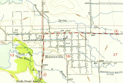 |
| USGS (Huntsville), 1955. |
SR 85 would have come into Huntsville directly from the south along what is now 7450 East (right by that "4902" label). It's not clear exactly how it ultimately connected to 39, but based on a 1940 census map (which I won't bother putting here as it shows pretty much the same thing) it appears 85 immediately turned north on 7500 East and proceeded up to 39 at First St.
By the way, much of that alignment is no longer drivable, for the same reason 39 no longer goes through Huntsville itself: in 1957, Pineview Dam was raised to its modern height, and much of the land south of Huntsville was flooded. However, during times of low lake levels, the old alignments can still be seen, with old 39 at left across the mud flats and old 85 to the east, directly south of the "Huntsville" label on the satellite image below.
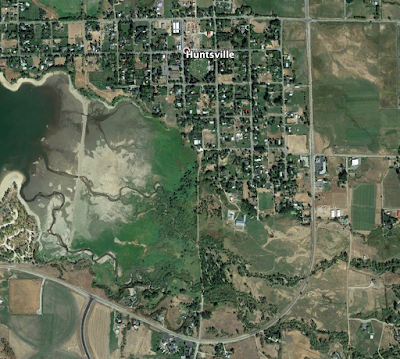 |
| Google Earth, 2018. |
However, 85 didn't last long enough to be affected by those realignments - the route was decommissioned in 1945 - only ten years after it was created. The road itself would continue to serve as a seasonal, locally-maintained dirt road.
Around this same time was the opening of Snow Basin (now Snowbasin) in the Wasatch mountains east of Ogden and west of the Trappers Loop road. This area had been previously been over-logged and overgrazed, and the land surface had been stripped essentially bare due to these aggressive practices. As a result, it began to produce debris flows whenever it rained hard enough (similar to a wildfire burn scar), and eventually a heavy summer thunderstorm in 1923 caused a major flash flood that killed many people and washed away several businesses. Ogden and Weber County, determined to never let that happen again, bought up the land in that area and transferred it to the Cache National Forest for restoration. The Forest Service and local skier Alf Engen committed to creating a ski resort recreational destination there. A rope tow opened in 1939, but there was no easy road access to the new ski area until 1940, when the Civilian Conservation Corps built a road south to the new resort from SR 39. That was added to the state highway system the next year as SR 226, and SR 227 was designated at the same time in the same area:
Route 226. From route 39 near Huntsville southwesterly to Mt. Ogden.
Route 227. From route 39 near the Pine View Dam southeasterly to route 226.
Below is a USGS topo map of the Snow Basin area:
 |
| USGS (Snow Basin), 1955. |
SR 226 is shown clearly there, and as you can tell by comparing with a modern map, it does not match the current SR 226 to Snowbasin (we'll get to that in a minute), and the original entrance to the ski resort was also at a different location corresponding to what Google currently labels "S Wc226 Rd". But what about 227? Based on the legal description, SR 227 was supposed to follow Wheeler Creek, which has its headwaters at the base of Snowbasin, flows north parallel to 226 for a bit, then turns north and empties into the Ogden River right below Pineview Dam. 227 actually appeared on this map:
 |
| Flying A Service (Salt Lake City), 1944. |
This is fascinating, but I believe it's an error. As far as I can tell, nothing was ever built along the creek between 226 and 39. The 227 designation would be deleted in 1953.
No further changes occurred in this area for over thirty years. But in 1984, at the request of Morgan and Weber county officials, the old Trapper's Loop Road (pre-1945 SR 85) was restored to the state system, this time as SR 167. The 1985 legislature approved that addition, defining the route as follows:
From Route 84 northerly via Trapper's Loop Road to Jct. Route 39 south of Huntsville.
Now, one might notice that Trappers Loop Road ends at Old Highway Road (old US 30S) and does not actually intersect I-84. That connection may have been planned to be constructed early on, but other issues with 167 soon took priority. The original idea was that UDOT would reconstruct and pave old Trappers Loop Road to modern state highway standards, but it was quickly realized that this would be prohibitive due to steep grades near Huntsville and other geological considerations including unstable soil and landslide areas. As a result, it was decided that an entirely new alignment would be built about a mile west of the old one, and this was approved in a 1987 Utah Transportation Commission resolution:
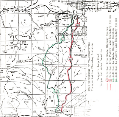 |
| UDOT, 1987. |
The decision of what to do with the old road was apparently quite contentious. Landowners on the Morgan County side wanted the old road closed immediately and given over to private control, as they believed this would decrease trespassing and property damage that they were experiencing. However, Weber County wanted the road kept open and under some level of public control, because they believed trespassing and property damage would actually increase if it were to be turned to private control. It seems several land parcels in this area were not adjacent to the old road, so one would have to travel across other property to access these areas. Owners of these non-adjacent parcels were worried that eliminating the public right-of-way would weaken and hinder their access rights, while other owners were worried that trespassing across their land to access these parcels would increase.
Ultimately, it was determined that the old road would remain under UDOT maintenance, open as a seasonal road as it had been for years before, until the new western alignment opened. As soon as that happened, SR 167 would be moved there, and Old Trappers Loop would be returned to the counties, which would then be able to do as they pleased with it.
The new Trappers Loop Road opened in September 1989, as a three-lane road (two uphill lanes, one downhill). As promised, Morgan County rapidly abandoned their section of the old road (though it looks like part of it has since been incorporated into a newer subdivision). In fact, the south end of the old Trappers Loop is barely even noticeable today from Old Highway Road, appearing as an inconspicuous dirt driveway with a faded ROAD CLOSED sign (Google maps link). The Weber County side is still drivable for some distance but is now closed and gated off about a half-mile up from SR 39.
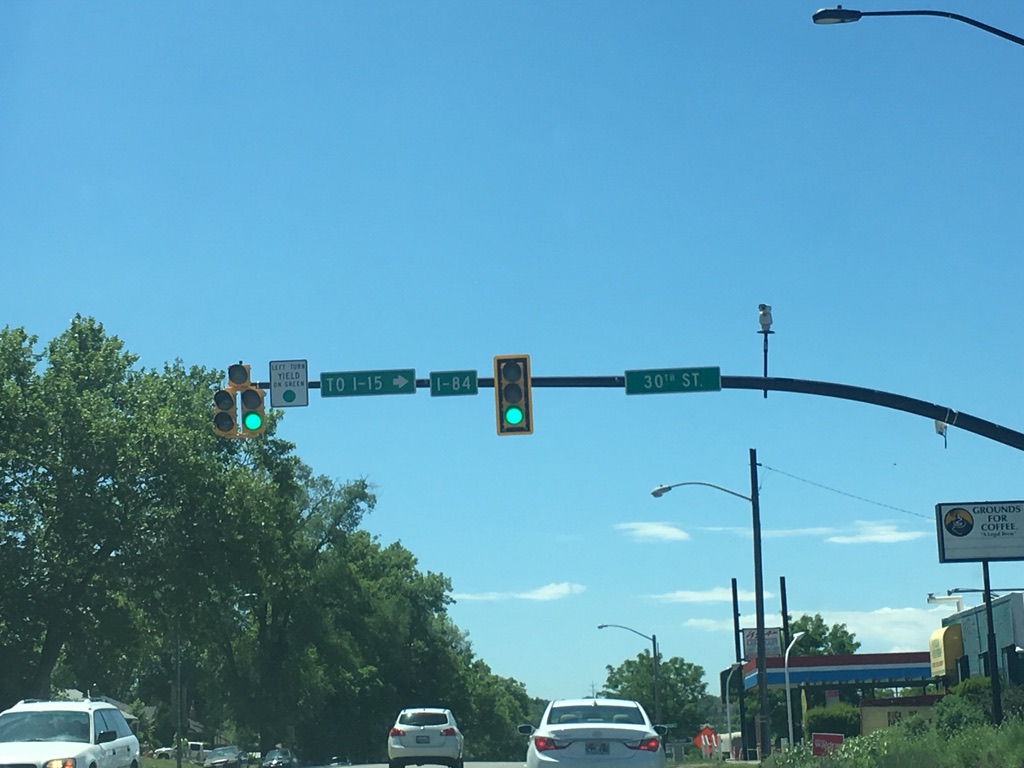
The opening of New Trappers Loop opened a couple more cans of worms. The first was the south end of SR 167, which did not connect to any other state highways or the interstate. To remedy this, SR 167 was extended west along Old Highway Road to I-84 exit 92 in 1990.
 |
| UDOT, 1990. |
The other issues involved the potential of access to Snowbasin from the new highway. It was realized early on that it would probably be fairly easy to construct a road from SR 167 west to Snowbasin that would be much shorter and probably safer than the existing connection from SR 39. Further pressure to build this road came when Salt Lake City was awarded the 2002 Winter Olympics and Snowbasin was chosen as the venue for the Downhill, Super-G, and Combined ski races. In 2001, UDOT awarded a contract to build this road, and the old alignment would be transferred to Weber County as soon as the new road was built and UDOT had done one final repave on the old road. The new road was designated as a relocation of SR 226.
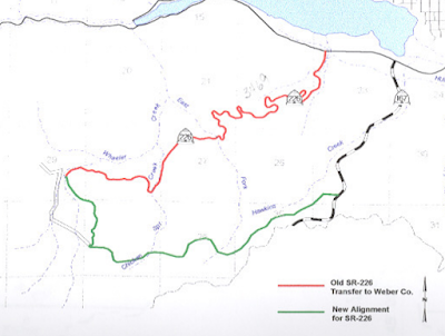 |
| UDOT, 2001. |
What's interesting about this is that the route endpoints weren't the same. Snowbasin built a new base area slightly to the northwest of the old base, so the new SR 226 actually overlapped around a half-mile of the old one (though in the opposite direction), and this created essentially one long connection from SR 39 to SR 167 that went by Snowbasin. Snowbasin planned to build a roundabout at the intersection of this road and the road to the new base area. UDOT wanted no part of constructing or maintaining this roundabout, so the west end of the new SR 226 is just east of that intersection.
(By the way, that roundabout was never built. But there's still plenty of room for one.)
UDOT retook temporary jurisdiction of the old SR 226 alignment between January 1 and March 15, 2002 so that there would be two state-maintained roads to Snowbasin during the Olympics. After that, the Old Snowbasin Road was given back to Weber County for good, and it is now inventoried as Federal Aid Route 3469. For several years, the county continued to maintain it as a summer-only alternate route to Snowbasin. However, this proved quite difficult as it travels through an especially landslide-prone area, and the road never opened for summer 2011 due to the severe landslides and road damage following the exceptionally wet 2010-11 winter season. Since the road is no longer necessary as a through route, the county moved quite slowly to fix it. According to one blog post I found, the county repaired some segments in 2014 and was on track to open the road in summer 2015...but I don't think that ever happened, and it now appears they've pretty much given up on ever reopening it. The old Snowbasin Road is now permanently closed to automobile traffic between Snowbasin and the Art Nord Trailhead, which is about halfway up to the ski area from SR 39.
Despite those issues in the area, ever since the Olympics SR 167 and SR 226 have remained intact with only routine maintenance and no route changes. UDOT's long range plans does have an extension of Trappers Loop Road south to I-84, where a new interchange will be built; however, this is currently unfunded and likely won't happen before 2040 at the absolute earliest. If the current plan is any indication, Trappers Loop will be widened to four lanes long before any interchange gets built, and I can't see even that happening for at least another 15-20 years.
Route Photos
SR 167
Photos from this route were taken in June 2019 and August 2021. Should be fairly obvious based on background colors which is which. :)
 |
| Initial reassurance shield after turning onto the highway. Apparently this is also a Utah Scenic Backway, which is weird because this road is hardly "back". This is probably the only backway that's three lanes the entire way. |
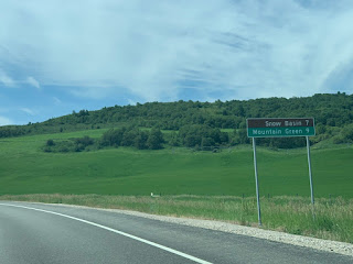 |
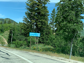
| 7 miles to Snow Basin, which is still typically spelled the old way on UDOT signage (two words instead of one). Another 2 miles to Mountain Green. |
 |
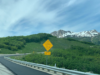
| A typical sign for a Utah mountain road. |
 |
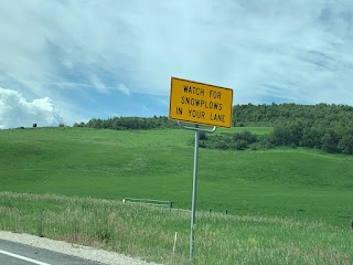
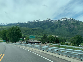
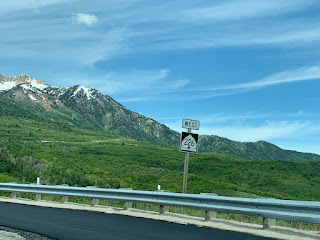
| As we climb up higher, we'll start getting the tall orange poles that help snowplows find the road during heavy winter storms |
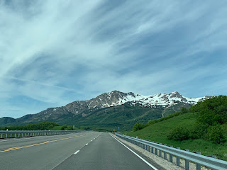 |
| Awesome views abound on this road in the springtime. |
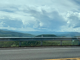 |
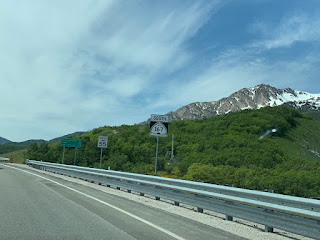
| Looking to the south into the Morgan Valley. This stretch of 167 meanders across the Ogden/Weber river divide and thus the Weber/Morgan county line for some time |
 |
| Coming up on SR 226, the New Snowbasin Road. |
 |
| Turn right for SR 226 west, which goes to Snowbasin and provides access to the National Forest |
 |
| SR 167 reassurance shield after that junction. We'll cross the ~6040 foot summit and enter Morgan County for good here. |
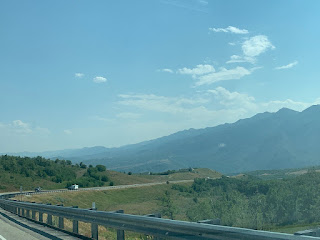 |
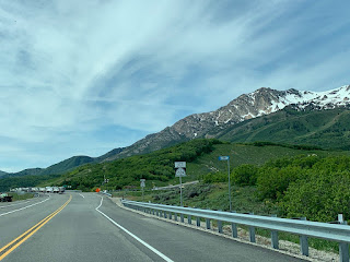
| The descent into Morgan County features great views of the eastern side of the Wasatch ridgeline, which is a lot less steep than the western side |
 |
| This little sign welcomes us to Mountain Green. |
 |
| At the bottom of Trappers Loop Road, we can turn left for Morgan or right for Ogden and Salt Lake City |
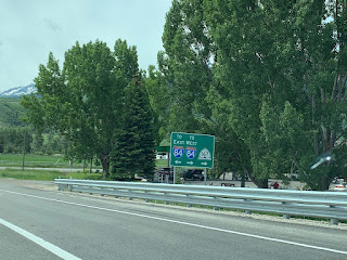 |
| SR 167 will turn right on Old Highway Road towards I-84 west. That's a half-diamond interchange with no access to I-84 east, so turn left if that's your ultimate goal. |
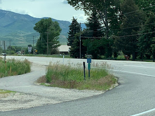 |
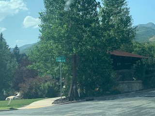
| Old Highway Road to the east is Federal Aid Route 1978. |
 |
| SR 167 southbound reassurance shield after making that right turn. |
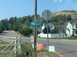 |
| The signage of this road varies wildly. Most newer street signs simply say "Old Hwy"... |
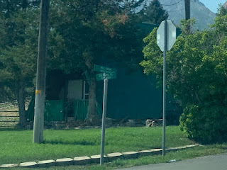 |
| ...some use the full "Old Highway Rd"... |
 |
| ...while others use "Old Highway SR-167" - which isn't quite true, since this is still 167 |
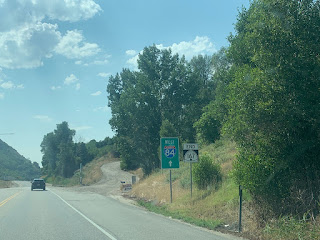 |
| SR 167 ends not far ahead and defaults into an on-ramp to westbound I-84. |
SR 226
All photos here were taken June 2019.
 |
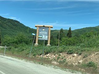
| Reassurance shield posted as we leave 167 towards Snowbasin |
 |
| Despite the ski resort, this road is not even plowed at night. They can get away with this because Snowbasin does not have any lodging at the base, nor does it have night skiing. |
 |
| These ski-run type signs tell us to continue ahead 1/4 mile to Snowbasin. These are probably there from when the base area was originally moved |
 |
| State maintenance ends. |