Of all the highways in Utah, I'd have to put State Route 12 at the top of my list of favorites. SR 12 is one of those roads you drive not because you like roads, but just because it exists. The scenery is truly unbeatable.
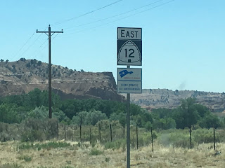
A fancy sign near the west end of the route.
The highway begins at US 89 south of Panguitch and runs through Bryce, Tropic, Cannonville, Henrieville, Escalante, Boulder, and Grover before reaching its eastern terminus at SR 24 in Torrey. It passes through the Grand Staircase-Escalante National Monument and is a major connecting route for Bryce Canyon and Capitol Reef National Parks. Today, the route is known as the Journey Through Time Scenic Byway and is the state's only All-American Road.
Route History
The first roads that would ultimately become part of SR 12 were added to the state highway system in 1914, running from US 89 at Bryce Canyon Junction (located not at today's SR 63 junction, but south of Panguitch) to the town of Tropic. The road from Antimony south to Widtsoe and east to Escalante was also added, and it was extended northwest to US 89 at Junction the next year.
In 1923, a forest road was built extending south from Widtsoe to Bryce Canyon, intersecting the east-west road to Tropic at Tropic Junction (today's SR 12/63 intersection). By that time, the state road commission had begun assigning numbers to the more well-traveled routes according to a 1923 map; the route from Bryce Canyon Junction through Tropic Junction to Bryce Canyon was assigned SR 12.
The state's first comprehensive statewide numbering system was assigned in 1927, so the remaining state-maintained roads in the area were numbered at that time. SR 12 was expanded to also include the road from Tropic Junction east to Tropic. SR 22 was assigned to the north-south road from Tropic Junction north through Antimony, while the Widtsoe-Escalante alignment became SR 23. The Rand McNally map from that year did not explicitly show the numbered routes (I have added them in blue below) but does give an idea of the general sparsity of roads in the area at the time. Also note the "Bryce Canyon National Monument" designation - it would be upgraded to a Park the next year.
 |
| Rand McNally (Utah), 1927. |
The state made an effort to renumber some route spurs in 1931, so the segment from Tropic Junction east to Tropic was renumbered to SR 54 at that time. Two other changes of note occurred that year. The first was the addition of SR 117, which ran south from SR 24 through Teasdale to Grover (this is now Teasdale Road). Secondly, the road continuing on east from Tropic to Henrieville was added to the state system as SR 120...which seems a bit silly, because it and SR 54 terminated end-to-end with each other at Tropic. That was fixed in 1935, when 54 was extended to absorb 120. Those changes can be seen on this Rand McNally map from 1940:
 |
| Rand McNally (Nevada-Utah), 1940. |
SR 23 was extended east from Escalante to Boulder the next year, along a new alignment south of the Hell's Backbone road which can be seen as the road from Escalante to Boulder on the map above. In 1947, SR 54 was extended to SR 23 near Escalante and extended over it eastward to Boulder. Since the remaining portion of SR 23 had been functionally replaced by the new roadway, SR 23 was decommissioned at that time. SR 117 was extended south from Grover to Boulder in 1957, giving it a mutual terminus with SR 54. Those changes can all be seen on the 1959 USGS Utah map. SR 117 would be absorbed into SR 54 in 1966.
In 1969, SR 54 became an extension of SR 12...but only as far as the Dixie National Forest boundary north of Boulder - the remainder of the route north to SR 24 at Teasdale was decommissioned. SR 22 south of Antimony was also decommissioned at that time. This left SR 12 as an east-west route from Bryce Canyon Junction to Boulder with a short spur from Tropic Junction to Bryce Canyon National Park - this spur became SR 63 in 1975.
Finally, SR 12 gained its present configuration in 1985, when it was extended north from Boulder mostly along what had been SR 54 before 1969. However, it split from the old SR 54 at Grover, running more directly north to SR 24 at Torrey.
The entire route has also recently been designated as USBR 70.
Route Photos
All photos on this page were taken in June 2018.
SR 12
We'll begin at Bryce Canyon Junction at US 89 and head east, passing a pair of reassurance shields and a mileage sign after crossing the Sevier River.
After that, we climb up the scenic Red Canyon, which has not one but two tunnels, as we ascend the Paunsaugunt Plateau.
At the top of that canyon, we'll enter the watershed of the East Fork Sevier River, which drains the western half of Bryce Canyon National Park and empties into the Sevier north of here at Kingston. The Sevier ultimately drains into the Sevier Lake bed in western Utah, but most of the time no water actually reaches the lake
Soon after, we'll come upon the junction with SR 63 which splits off to the south to Bryce Canyon. The road to the north here is Johns Valley Road, which as mentioned above was SR 22 before 1969.
After that junction, we'll pass through the northernmost reaches of Bryce Canyon National Park and also cross the Great Basin Divide. Water on the far side of that crossing will drain down the Paria River and into the Colorado.
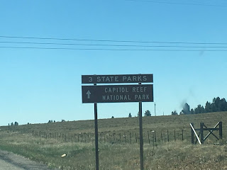
No shortage of parks in this area, either. SR 12 goes on from here to serve three state parks and Capitol Reef National Park.
Heading east from here, we'll pass through Cannonville, home of the Grand Staircase-Escalante National Monument Visitor Center.
As we head east from Cannonville we get into the really scenic parts - as if what we just drove through wasn't good enough. At some point we'll cross into the Escalante River drainage basin, which drains into the Colorado at Lake Powell.
From here we'll pass through Escalante, which is the largest settlement on SR 12 at about 800 people.
 |
| Turn left in Escalante for the historic Hells Backbone Road. |
The part between Escalante and Boulder is even better, and these photos won't do it justice.
After passing through Boulder, we'll leave the desert environment we've spent the last 80ish miles in and start climbing the Aquarius Plateau, which is surprisingly high. This segment is known to close occasionally in winter due to heavy snow.
 |
| Open range is a real concern out here - I actually had to stop for cows multiple times. |
The highway tops out at 9600 feet at a pass known as Boulder Mountain, where we enter the Fremont River watershed. The Fremont River joins with Muddy Creek to form the Dirty Devil River, which will also join the Colorado at Lake Powell.
After coming down Boulder Mountain and passing through Grover, SR 12 will descend into Torrey.
 |
SR 63
Heading south from SR 12, we'll get a reassurance marker:
Bryce Canyon City features the only traffic light in Garfield County:
Heading back north from the town, we return to SR 12:
I'm fascinated UDOT has actually posted a "TO SR-22" sign here. Perhaps it might not be a bad idea to undo the 1969 truncation and restore SR-22 to Johns Valley Road here.


No comments:
Post a Comment