Sunday, March 29, 2020

Highways of the eastern Rush and Cedar Valleys

First, a little bit of geographic background. The Cedar Valley lies west of the Lake Mountains and is the part of Utah County that nobody really thinks about, but it contains the rapidly growing area of Eagle Mountain. The Oquirrh and East Tintic Mountains separate it from the Rush Valley to the west, which has maintained its rural, undeveloped character. The Oquirrhs and East Tintics are geographically the same mountain range, but are conventionally separated by Fivemile Pass.

Source: ESRI

As you can tell from looking at a map today, the primary highway connecting these areas today is SR 73, which crosses Fivemile Pass in the center of the map above. But 73 has moved around quite a bit through the years, and there were historically other highways in the area as well.


Route History


Early Routes


SR 73 was first defined by the state legislature in 1933, with the following description:
From Jordan Bridge on state highway number 68 southwesterly via Cedar Fort, Fairfield and Topliffe to connect with state highway number 36.
This essentially corresponds to a routing equivalent to the modern routing through the Cedar Valley, but at Fivemile Pass it diverged from the modern alignment and turned to the south-southwest, roughly following the old Fairfield Branch of the Union Pacific Railroad. It passed through the railroad siding of Topliff and ended at a junction with SR 36 southeast of Vernon.

In addition to the obvious difference west of Fivemile Pass, the route also followed older alignments through Cedar Fort and Fairfield:

US Census, 1940.

US Census, 1940.

Essentially, the original route through Cedar Fort was along 100 East rather than today's 200 East, and in Fairfield it was 1680 North, 18040 West, and 1540 North.

The original 73 alignment through Topliff didn't last more than two years, though. In 1933, SR 73 was rerouted at Fairfield; instead of going west towards Fivemile Pass, it was sent southward to connect with SR 26 (which would become US 6 in 1937) at a place called Homansville, just east of Eureka. That was shown on this Rand McNally map:

Rand McNally (Idaho-Montana-Wyoming), 1937.

Looking at a modern map of the area, you might think 73 followed what's now 18150 West and Homansville Pass Road. But at least in the northern Cedar Valley, it followed a different alignment west of modern 18150 West:

US Census, 1940.

The alignment at the southern end was also a bit more complicated than the above map indicates. Instead of proceeding directly south to Homansville, the route swung east towards Elberta before coming back into Homansville from the northeast.

US Census, 1940.

Additions to Ophir and Mercur


In 1935, a new SR 180 was created, and this was an unusual route because it had a split eastern terminus. It began at SR 36 at St. John Station (located at the modern railroad crossing between today's 73 and 199 junctions) and headed southeast on what is now 73 before splitting at Ophir Junction (where today's SR 73 intersects the road to Ophir). One branch went east through Ophir Canyon to the mining town of Ophir, while another continued a bit further southeast before heading up Mercur Canyon to the mining town of Mercur.

US Census, 1940.

The road southeast from Mercur eastward down Manning Canyon to SR 73 at Fairfield Junction (halfway between Fairfield and Cedar Fort) was added to the system in 1939 as SR 202 - this probably ran either along or very close to what is now labeled Lewiston Road on maps. With that addition, in addition to the previously described SR 73, we had a SR 180 heading east from SR 36 with spurs to Ophir and Mercur and a SR 202 connecting SR 73 to Mercur. With the exception of SR 202, which didn't make the map, this all is visible on this 1940 Rand McNally:

Rand McNally (Nevada-Utah), 1940.

Also notice that this map does a better job with showing SR 73's alignment...but only in some ways. It shows the turn to the east in the southern Cedar Valley, but it has 73 continuing in that direction all the way to Elberta. There's a chance this may have been the case (the Census map above is not clear whether 73 went southeast to Elberta or southwest to Homansville). But if 73 ever did go to Elberta, the legislative description was never updated.

At any rate, the route system in the area was simplified a bit in 1941. Previously, SR 202 and one of the SR 180 spurs terminated at each other in Mercur. That year, SR 202 was extended down to Ophir Junction, absorbing the Mercur spur of 180.

1945 Changes


In 1945, the routes in the area were substantially reconfigured. First, SR 73 was truncated to Fairfield Junction; the portion between Fairfield Junction and Fairfield became a new SR 191, while the remainder of the road south to US 6 was removed from the system. From Fairfield Junction, SR 73 was extended west all the way to St John Station on SR 36. That extension replaced SR 180 between St John Station and Ophir Junction, and SR 202 between Ophir Junction and Mercur Junction.

But what about the connection from Mercur Junction to Fairfield Junction? That's where things get interesting. 73 proceeded southwest from Fairfield Junction to the bottom of Manning Canyon (along former SR 202), and was then defined on a proposed road from there southwest to Fivemile Pass, then northwest to Mercur Junction. The legislative description of SR 202 was cut back to just the portion west of Mercur, with the piece eastward down Manning Canyon to SR 73 decommissioned.

However, until this proposed road could be built, the SR 73 routing from Fairfield Junction to Mercur Junction was through Mercur. In other words, no mileage was removed from the system in 1945, and SR 202 became an unsigned legislative designation for the portion of SR 73 between Mercur Junction and Mercur. Once this new Fairfield Jct-Fivemile Pass-Mercur Jct road was complete, 73 would be moved there, 202 would be cut back to Mercur Jct-Mercur, and Manning Canyon would be removed.

In addition to all this, a new spur to the Deseret Chemical Depot was created in 1945 as SR 198. This is all rather hard to understand without a map, so here's one I made to help clarify.

Rush and Cedar Valleys in 1945.

In addition, by the early 1950s the modern alignments through Cedar Fort (200 East) and Fairfield (northwest bypass) had been established.

Further realignments


SR 73 was finally rerouted in 1953...but not quite to the alignment that had been proposed in 1945! The new 73 alignment did follow the previously proposed road from Mercur Jct to Fivemile Pass, but no direct Fivemile Pass-Mercur Junction road would ever be built. Instead, SR 73 was routed from Fivemile to Fairfield along its original 1933 alignment, and then north to Fairfield Junction - absorbing SR 191.

In addition to the 73 reroute, SR 202 was also decommissioned that year, removing Mercur from the state highway system. The 1959 USGS map of Utah showed this change, but also left off the existence of SR 198:

USGS (Utah), 1959.

SR 180 was eliminated in 1961, removing Ophir from the state highway system. SR 198 was removed from the system in the 1969 mass decommissioning. The route landscape in the area has not changed since, other than some changes over towards Saratoga Springs which are a story for another time.


Route Photos


In December 2019, I drove SR 73 through the Rush and Cedar Valleys. Below are some photos from then:

First reassurance shield heading east from US 6 towards the Oquirrh Mountains.

Directions were provided to Mercur and Lehi. Which is only interesting, because nobody lives in Mercur anymore. People still live in Ophir, which was left off this sign.

Stark Road is the main access road to the Tooele Army Depot's South Area.

It is also the former SR 198.

Reassurance shield after old 198.

Turn left here for the former SR 180.

Reassurance after old SR 180.

Another entrance to the Tooele Army Depot, but this one was never state maintained.

SR 73 beelines across the northeastern Rush Valley.

Turn left here for Mercur. This would put you on the old alignment of SR 202, later signed SR 73.

Continuing eastward, we gradually climb up the far southern foothills of the Oquirrh Mountains towards the East Tintics.

Turn right for the old Pony Express road to Faust.

At Fivemile Pass, we cross the Utah County line and enter the Cedar Valley. The Lake Mountains come into view in the immediate foreground, with the snow-capped Wasatch rising behind them.

Reassurance shield after crossing the pass.

City limits in this area are huge. We're still a few miles from any sort of civilization.

The Lake Mountains looked especially cool in the setting sunlight.

Looking south through the Cedar Valley.

Turn right in Fairfield for the former SR 73 alignment through the southern Cedar Valley. Today, it serves a landfill and an airport.

Fairfield is home to Camp Floyd State Park.

Watch out for deer - this is a good thing to keep in mind on just about any road in Utah.

As another example of large city limits, we'll enter Eagle Mountain here...but the collection of houses ahead is not in Eagle Mountain.

Turns out they're in Cedar Fort.

SR 73 now crosses the northern end of the Cedar Valley, with the Oquirrhs and Traverse Mountains visible in the background.

Cedar Fort was bigger than I was expecting it to be.

Cedar Valley is not a town, but a placename used by the postal service to serve all the towns out here under one ZIP code.

Another reassurance as we leave Cedar Fort

As we turn east, the Wasatch Range begins coming into view, with the Traverse Mountains at far left.

Snow fencing lines much of SR 73 in this area.

Turn right for Eagle Mountain Boulevard, one of the primary roads serving the town center of Eagle Mountain.

You might also see a migrating deer in this area.

Turn left for the Camp Williams Tickville gate, but as Camp Williams is a military base, this access is closed to the public.

The first traffic light appears at Sunset Drive. From here on out, SR 73 will get more and more urbanized as we enter the Utah Valley.

SR 73 is signed on traffic lights as the Cory B. Wride Memorial Highway, but I don't think anyone actually uses that name.

Another look at the street blade. Technically, this is not how a 2-line street blade is supposed to be used...but I think it looks cool.

After coming over a hill, we will come to an intersection with the Mountain View Corridor, where we'll junction SR 85 and 145.
Turn left for SR 85 and the Mountain View Corridor, or stay straight for SR 145 eastbound on Pioneer Crossing.

SR 73 ends here...well, kind of. It used to continue east through Lehi all the way to US 89, and the piece between I-15 and US 89 is in fact still SR 73. We'll discuss this in a future post.

Saturday, March 28, 2020

Scenic Byway 12: An All-American Road

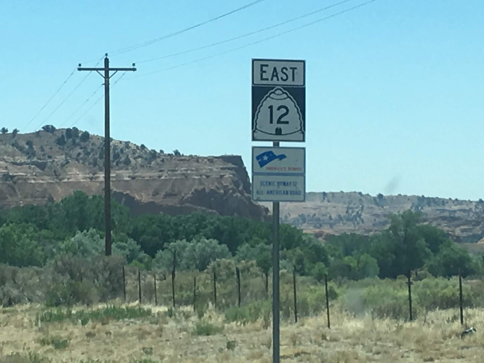
A fancy sign near the west end of the route.
Of all the highways in Utah, I'd have to put State Route 12 at the top of my list of favorites. SR 12 is one of those roads you drive not because you like roads, but just because it exists. The scenery is truly unbeatable.

The highway begins at US 89 south of Panguitch and runs through Bryce, Tropic, Cannonville, Henrieville, Escalante, Boulder, and Grover before reaching its eastern terminus at SR 24 in Torrey. It passes through the Grand Staircase-Escalante National Monument and is a major connecting route for Bryce Canyon and Capitol Reef National Parks. Today, the route is known as the Journey Through Time Scenic Byway and is the state's only All-American Road.


Route History


The first roads that would ultimately become part of SR 12 were added to the state highway system in 1914, running from US 89 at Bryce Canyon Junction (located not at today's SR 63 junction, but south of Panguitch) to the town of Tropic. The road from Antimony south to Widtsoe and east to Escalante was also added, and it was extended northwest to US 89 at Junction the next year.

In 1923, a forest road was built extending south from Widtsoe to Bryce Canyon, intersecting the east-west road to Tropic at Tropic Junction (today's SR 12/63 intersection). By that time, the state road commission had begun assigning numbers to the more well-traveled routes according to a 1923 map; the route from Bryce Canyon Junction through Tropic Junction to Bryce Canyon was assigned SR 12.

The state's first comprehensive statewide numbering system was assigned in 1927, so the remaining state-maintained roads in the area were numbered at that time. SR 12 was expanded to also include the road from Tropic Junction east to Tropic. SR 22 was assigned to the north-south road from Tropic Junction north through Antimony, while the Widtsoe-Escalante alignment became SR 23. The Rand McNally map from that year did not explicitly show the numbered routes (I have added them in blue below) but does give an idea of the general sparsity of roads in the area at the time. Also note the "Bryce Canyon National Monument" designation - it would be upgraded to a Park the next year.

Rand McNally (Utah), 1927.

The state made an effort to renumber some route spurs in 1931, so the segment from Tropic Junction east to Tropic was renumbered to SR 54 at that time. Two other changes of note occurred that year. The first was the addition of SR 117, which ran south from SR 24 through Teasdale to Grover (this is now Teasdale Road). Secondly, the road continuing on east from Tropic to Henrieville was added to the state system as SR 120...which seems a bit silly, because it and SR 54 terminated end-to-end with each other at Tropic. That was fixed in 1935, when 54 was extended to absorb 120. Those changes can be seen on this Rand McNally map from 1940:

Rand McNally (Nevada-Utah), 1940.

SR 23 was extended east from Escalante to Boulder the next year, along a new alignment south of the Hell's Backbone road which can be seen as the road from Escalante to Boulder on the map above. In 1947, SR 54 was extended to SR 23 near Escalante and extended over it eastward to Boulder. Since the remaining portion of SR 23 had been functionally replaced by the new roadway, SR 23 was decommissioned at that time. SR 117 was extended south from Grover to Boulder in 1957, giving it a mutual terminus with SR 54. Those changes can all be seen on the 1959 USGS Utah map. SR 117 would be absorbed into SR 54 in 1966.

In 1969, SR 54 became an extension of SR 12...but only as far as the Dixie National Forest boundary north of Boulder - the remainder of the route north to SR 24 at Teasdale was decommissioned. SR 22 south of Antimony was also decommissioned at that time. This left SR 12 as an east-west route from Bryce Canyon Junction to Boulder with a short spur from Tropic Junction to Bryce Canyon National Park - this spur became SR 63 in 1975.

Finally, SR 12 gained its present configuration in 1985, when it was extended north from Boulder mostly along what had been SR 54 before 1969. However, it split from the old SR 54 at Grover, running more directly north to SR 24 at Torrey.

The entire route has also recently been designated as USBR 70.


Route Photos


All photos on this page were taken in June 2018.

SR 12


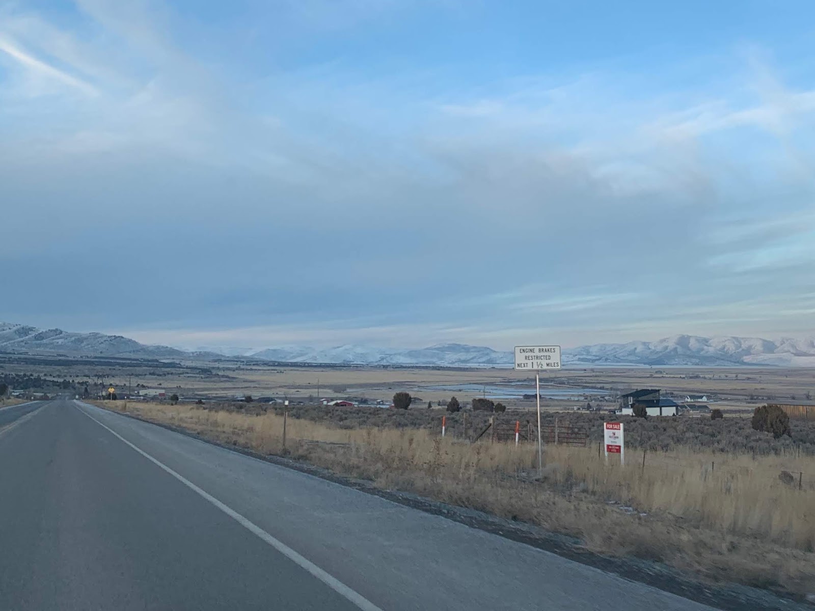
We'll begin at Bryce Canyon Junction at US 89 and head east, passing a pair of reassurance shields and a mileage sign after crossing the Sevier River.


After that, we climb up the scenic Red Canyon, which has not one but two tunnels, as we ascend the Paunsaugunt Plateau.


At the top of that canyon, we'll enter the watershed of the East Fork Sevier River, which drains the western half of Bryce Canyon National Park and empties into the Sevier north of here at Kingston. The Sevier ultimately drains into the Sevier Lake bed in western Utah, but most of the time no water actually reaches the lake


Soon after, we'll come upon the junction with SR 63 which splits off to the south to Bryce Canyon. The road to the north here is Johns Valley Road, which as mentioned above was SR 22 before 1969.


After that junction, we'll pass through the northernmost reaches of Bryce Canyon National Park and also cross the Great Basin Divide. Water on the far side of that crossing will drain down the Paria River and into the Colorado.


No shortage of parks in this area, either. SR 12 goes on from here to serve three state parks and Capitol Reef National Park.


Heading east from here, we'll pass through Cannonville, home of the Grand Staircase-Escalante National Monument Visitor Center.


As we head east from Cannonville we get into the really scenic parts - as if what we just drove through wasn't good enough. At some point we'll cross into the Escalante River drainage basin, which drains into the Colorado at Lake Powell.


From here we'll pass through Escalante, which is the largest settlement on SR 12 at about 800 people.


Turn left in Escalante for the historic Hells Backbone Road.

The part between Escalante and Boulder is even better, and these photos won't do it justice.


After passing through Boulder, we'll leave the desert environment we've spent the last 80ish miles in and start climbing the Aquarius Plateau, which is surprisingly high. This segment is known to close occasionally in winter due to heavy snow.


Open range is a real concern out here - I actually had to stop for cows multiple times.


The highway tops out at 9600 feet at a pass known as Boulder Mountain, where we enter the Fremont River watershed. The Fremont River joins with Muddy Creek to form the Dirty Devil River, which will also join the Colorado at Lake Powell.


After coming down Boulder Mountain and passing through Grover, SR 12 will descend into Torrey.


SR 12 will end here at SR 24, a route almost as scenic as this one. USBR 70 will also turn east here, following SR 24, SR 95, US 191, and US 491 to the Colorado state line.


SR 63


Heading south from SR 12, we'll get a reassurance marker:


Bryce Canyon City features the only traffic light in Garfield County:


Heading back north from the town, we return to SR 12:


I'm fascinated UDOT has actually posted a "TO SR-22" sign here. Perhaps it might not be a bad idea to undo the 1969 truncation and restore SR-22 to Johns Valley Road here.