This was a complicated post to write, so let's get down to business. Here, we'll cover the various iterations of the north-south highways between North Salt Lake and the Farmington-Kaysville area.
The original north-south route entered North Salt Lake along what's now US 89, then proceeded northeast into Bountiful along Main Street (note that involves a connection that can't be done anymore - we'll get to that later). After a very brief jog east on 400 North in Bountiful, it continued north through the rest of Bountiful and Centerville as Main Street, then entered Farmington as 200 East. The original highway then stair-stepped northwest through Farmington on 100 South, 100 East, State Street, and Main Street, then proceeded to the northwest along Main Street. It passed north through Kaysville and continued northwest on Main on towards Layton. (Notice how in almost every town it passes through, it runs along Main Street - this is usually a pretty good clue to the historic importance of a road.)
This highway was added to the state highway system in 1910, and was probably part of the very first state highway in Utah as it was part of the main north-south backbone through the state, and moreover was the primary road from Salt Lake City to Ogden - at the time, the state's two largest cities. It was also designated as part of the transcontinental Lincoln Highway in 1913, and some historical signage to this effect can still be found along it.
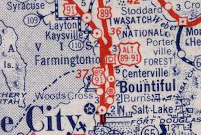
In 1919, the state legislature cut down a bit on the size of its early highway system, restricting it to a set of defined corridors and anything that had been improved with federal aid. Due to the importance of this corridor, it was included in section A of the 1919 law. When numbers were assigned to the most important state highways in the early 1920s, it became part of SR 1. And upon the creation of the U.S. highway system in 1926, it became part of US 91 and SR 1 became an unsigned legislative designation. Those last two designations can be seen on the map below:
 |
| Rand McNally (Utah), 1926. |
Note that the whole thing was already paved even by then. In 1931, evidently due to high traffic on the corridor, the state legislature created SR 106:
From South Bountiful on route 1 northerly and west of route 1 to junction with route 1 at North Farmington.
That was the first major bypass in Utah, and I believe the portion from Farmington to north of Bountiful was also the state's first divided highway. This western bypass split from the original route south of Bountiful and headed north along that city's 500 West, then continued due north to a point south of Farmington, then due northwest to North Farmington Junction, where SR 49 split off to run along the foot of the mountains to Ogden (that junction is at today's exit 397 on US 89). This bypass does not actually exist anymore north of Bountiful, as the modern I-15 and US 89 freeways were built directly on top of it. However, it is still intact through Bountiful, and it included a grade separation at the Bamberger Railroad - one of the earliest in the state. The railroad only lasted through 1958, but the bridge still exists and now carries a road (we'll get to that in a minute). It was originally known as the Parkin Overpass, a name that was still known by the 1960s but now is more or less lost to history.
Although the legislature created SR 106 in 1931, it appears the bypass may not have been fully built yet at that point. The first map I know of suggesting the existence of the bypass was on a 1932 map showing Utah's Federal Seven Percent System. I'm not familiar with what this was, though I assume it involved funding (if you know, hit up the comment section below). Regardless, it suggested there were two highways between Bountiful and Farmington:
 |
| USRC (Federal Seven Percent System), 1932. |
The grade separation at the Bamberger railroad was not complete until 1935, so the new bypass may not have been fully opened until then. Whenever that did happen, US 91 was moved to the western bypass. As a result, SR 106 began its life entirely as an unsigned legislative overlap. SR 1 lost its US highway pairing between south Bountiful and north Farmington... but instead of becoming a signed route, it appears it was designated as Alternate US 91.
US 89 was extended north through the Wasatch Front in 1938, entirely concurrent with US 91 between Springville and North Farmington Junction (following a long routing dispute that I will detail in a future post). Maps disagree on whether Alternate 91 also gained a concurrent Alternate US 89 designation at this time. The cartography on the Utah state maps during the 1940s was not great - they suggested US 89 followed the old routes and US 91 followed the bypass, which we know from other detail maps to be wrong. Here is the 1940 census enumeration district map, which confirms this and also showed that the stair-step through Farmington had been realigned into a direct connection from 200 East/100 South to 100 East/State Street:
That map showed Alt US 89. The 1939 Utah official map showed the US 89 extension, but only had Alt 91 on the old route. Same for a 1939 Rand McNally Nevada-Utah map. But that same map printed the next year had both:
 |
| State Farm/Rand McNally (Nevada-Utah), 1940. |
However, every other map made after that point that I have been able to find had the old route only as Alt 91. So Alt 89 may have only existed briefly in the early 1940s, and then it was decided that the additional designation was more trouble than it was worth. The Shell map below from 1950 has it only as Alt 91, and also does a good job showing how the bypass fit in with the surrounding roads:
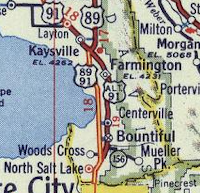 |
| Shell/Gousha (Utah), 1950. |
Regardless of the status of Alt US 89, it is clear that SR 1 was signed as Alt US 91 from south Bountiful to north Farmington during the 1940s and early 1950s.
By 1952, the state had begun to build a western bypass of Kaysville, which would run from Main Street in south Layton (then US 91/unsigned SR 1) southeast to a junction with the existing Farmington bypass (US 89/91/unsigned SR 106). While not quite a freeway, this bypass used a similar four-lane-divided expressway cross section to most of the earlier bypass. It was under construction at the time the USGS map below was made, which again showed the older road as simply Alt 91:
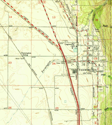 |
| USGS (Farmington), 1952. |
In 1953, many route numbers in the area were adjusted to account for the construction of this expanded bypass, which would become a realigned US 91 upon its completion. The main thing was that SR 1 and SR 106 were switched, so that SR 1 would follow the continuous bypass and remain a silent designation for US 91 from Bountiful all the way up through Kaysville. SR 106 was placed on the old roads from south Bountiful to North Farmington Junction, and also extended north along the now-bypassed US 91 alignment through Kaysville to south Layton. Since US 91 would no longer intersect its original alignment in Farmington, Alternate US 91 was finally done away with, and all of SR 106 from Bountiful to Layton was a signed route. The remaining section of original bypass from west Farmington to North Farmington Junction remained US 89, but now needed a new state route underlay. SR 49, the existing designation for US 89 through northeast Davis County, was extended south to the US 91/SR 1 junction as a result. The new bypass was complete by 1955:
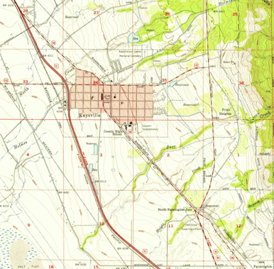 |
| USGS (Kaysville), 1955. |
This had the effect of moving the US 89/US 91 split about two miles to the south, creating the earliest form of Lagoon Junction in west Farmington. That was the first grade-separated interchange in Utah. Unfortunately, it has been completely obliterated by the modern form of that junction, which is the I-15/US 89/SR 67 interchange occasionally known as the Wasatch Weave.
The next change to these routes came in 1960. In December of that year, the State Road Commission shifted SR 106 west two blocks in Bountiful. Heading south into Bountiful, SR 106 now jogged west two blocks on 400 North (absorbing the easternmost part of what by then was SR 131), then went south on 200 West. South of the historic downtown district, it turned and followed the old Bamberger Railroad right-of-way southwest to US 89/91. That adjustment is shown on this map from the State Road Commission's resolution making the change:
 |
| USRC, 1960. |
Remember that early grade separation we mentioned earlier? Rather than being torn down, it got repurposed into a grade-separated interchange where SR 106 now ended at US 89/91. Although the legislature approved that shift the following year, the Bamberger right-of-way road and its interchange at 89 were not complete until sometime between 1962 and 1965 per Historic Aerials. The 1965 HA image of the interchange is shown below (apologies for the watermark, but I don't own the image and I'm not about to drop money on a blurry picture from 60 years ago):
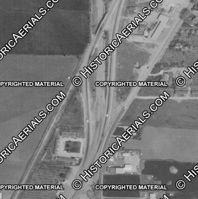 |
| Historic Aerials, 1965. |
A close look at that image reveals that when the interchange was completed, access was closed off between US 89/91 and the original part of Main Street. That persists to this day, and as a result it is currently impossible to drive the exact route of the original Lincoln Highway and US 91 through Bountiful.
However, between the time the legislature approved that shift and the time it was complete, a whole bunch of legislative changes occurred thanks to interstate construction. I-15 was completed from the Salt Lake County line and 500 West in Bountiful in 1960, and in 1962, the state redefined a lot of legislative underlays to accommodate the interstate system. SR 1 was shifted to follow the new I-15, so a new state number was needed for the portion of US 89/91 between its I-15 interchanges at Becks (basically the Salt Lake County line) and in north Bountiful at 500 West. The 1962 legislature created a new SR 169 to serve as an unsigned state designation for US 89/91 between those two points:
From Becks Interchange of I-15 Route 1 northerly to a point at Bountiful north city limits.
The "point at Bountiful north city limits" simply meant the 500 West/US 89-91 interchange at I-15 per the attached maps, and that language was rewritten in later years to indicate this more clearly. Here is a map from the resolution creating this route:
 |
| USRC, 1962. |
However, the same legislature also redefined SR 106 to extend it all the way down 89/91 to the Becks interchange as an unsigned designation:
From Becks Interchange on Route 1 via North Salt Lake, Parking Overpass, Bountiful and Kaysville to Route 1 south of Layton.
It's sort of irrelevant, as neither the 106 extension nor any of 169 would have been signed, but this produced a legislative SR 106/SR 169 concurrency between Becks and Parkin Junction. This, to my knowledge, is the only instance of a legislative route concurrency anywhere in Utah at any point in history besides the I-15/I-80 overlap in Salt Lake City. Even US highways in the state today are defined as discontinuous routes if they have a concurrency with another more important route, with only one route on a given roadway. And what's more - this 106/169 overlap in Bountiful in particular was pointless! 106 could have easily maintained its signed ending at Parkin as its official endpoint, with 169 taking over the rest of the way down to Becks.
I wonder if the legislature ever realized they had defined both routes on the same road. They would remain that way until the unsigned underlay system was eliminated in 1977.
In 1966, SR 106 got extended again...but in the other direction. That year, SR 1 was moved to I-15 between south Layton and Hot Springs Junction, all the way up at the Weber-Box Elder County line. SR 106 was extended north to take over all of former SR 1 between those two points. That meant running northwest on Main Street through Layton, then continuing on State Street and veering north on Main Street through Clearfield and Sunset, entering Weber County and Roy on 1900 West, turning northeast on Riverdale Rd through Riverdale, then north on Washington Blvd through Ogden, then northwest on Harrisville Rd. But because this was all a legislative underlay for US 91, none of it was signed. The map below from the 1966 resolutions illustrates this switch:
 |
| USRC, 1966. |
I-15 continued to be built through the remainder of southern Davis County in the late 1960s, and was probably finished by 1970 if not a bit earlier. Between north Bountiful and south Layton, it was built directly on top of US 91, which was concurrent with the new interstate through this portion. US 89 was and is still concurrent from north Bountiful to Farmington, where it diverged from 91 to the east.
In 1969, the portion of Main Street between 200 North in Kaysville and I-15 in Layton was deleted from the state highway system. Rather than leave a gap in SR 106, the state elected to transfer the portion of 106 from Layton northward to other routes - notably SR 84 (Main Street/State Street, 1900 West) and SR 50 (Riverdale Rd, Washington Blvd, Harrisville Rd). That particular change would not have produced any signage changes on the ground, as this would all still be US 91 for a few more years.
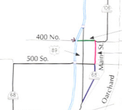
Apparently, the original plan for the north end of SR 106 was to have it turn west from Main Street onto 200 North in Kaysville, then proceed to the I-15 interchange. However, before that could go into effect, it was decided that even more adjustments needed to be made with the upcoming reconstruction of North Farmington Junction, where Main Street/SR 106 crossed US 89. Presumably due to high crash rates, the junction was proposed to be reconfigured such that traffic would not be able to cross US 89, and there would be no left turns from southbound US 89. In order to maintain full access between all directions on 89 and all directions on 106, the north end of 106 was sent west on Shepard Lane, which crossed 89 at a conventional intersection. The portion of former 106 between Shepard and US 89 became a new SR 272, while the part from US 89 through Kaysville to I-15 was given the SR 273 designation. That was shown on the resolution map from the following year - green beehives indicate the new numbers, while red ones show the former routes:
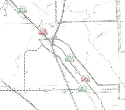 |
| USRC, 1969. |
Utah gained approval from AASHTO to move US 91 onto I-15 throughout the state south of Brigham City in 1971. I'm not sure how much of that ever made it onto signage, though, because only three years later it was entirely decommissioned south of Brigham City.
Utah finally did away with the unsigned legislative designations in 1977. As a result, SRs 1, 49, and 169 were decommissioned and replaced with their signed interstate and US routes, and the south end of SR 106 was truncated back to its signed ending at the Parkin Overpass.
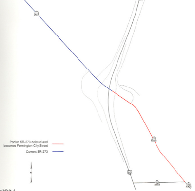
That configuration lasted until 2001, when the city of Bountiful requested to maintain the nine blocks of 200 West from 400 North to 500 South. The Transportation Commission agreed to this request in February 2001. As a result, SR 106 was truncated back to 400 North and extended west along that street, to the west end of the approach to the Union Pacific Railroad bridge just past I-15. That entirely absorbed SR 131, which had run from that railroad bridge east on 400 North to 200 West. The portion of 106 south of 500 South, along 200 West and the old Bamberger right-of-way, became an extension of SR 68. The map below from the commission resolution illustrates this well: red shows the part of 106 transferred to local jurisdiction, green shows the extension of 106 over all of 131, and blue shows the extension of 68 southward over the remainder of 106:
 |
| UDOT, 2001. |
That settled the south end of 106 for good (at least up to the point of this writing), but changes were ongoing at the other end at the same time. Back in 1998, UDOT and the city of Farmington had signed a cooperative agreement that would transfer all of SR 272 (i.e. Main Street from Shepard north to US 89) to city maintenance and remove it from the state highway system once a certain set of conditions had been met - mostly, once the state had paid for a reconstruction of the road to a 41-foot pavement width plus sidewalks, gutters, storm drains, and other improvements.
Those projects were probably completed within the next year or two, and it appears the city assumed maintenance responsibility at that point. But apparently nobody told the numbering people at UDOT. By 2001, as part of the general movement to upgrade US 89 to a freeway through Farmington, the complicated intersection at North Farmington Junction was being replaced with a standard diamond interchange (US 89 exit 397), making Main Street drivable as a continuous road through US 89 once again. As a result, there was no longer any reason for SR 272 and SR 273 to remain separate routes, and the Utah Transportation Commission - yes, the same commission that had approved deleting 272 from the state highway system in 1998 - signed a resolution in March 2001 extending the SR 273 designation south over what had been 272 to SR 106 at Shepard. That made it into the 2001 legislative descriptions.
Within a few weeks, Farmington found out about that resolution, and they sent UDOT a passive aggressive "hey, we want our road back" letter. So in June 2001, the commission signed another resolution removing all of what had been SR 272 from the state system, truncating the south end of SR 273 back to US 89 at North Farmington Junction. It has remained there since.
 |
| UDOT, 2001. |
Route Photos
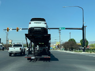
US 89 (Becks-N. Bountiful)
These photos are a mixed bag but generally are from April or May 2020. Any others that weren't taken during those dates were at least standing during those dates.
 |
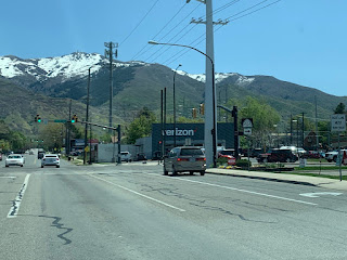
| Heading north on US 89 from the I-15 interchange on the Salt Lake County line, we'll pass this speed limit sign with "US 89" in yellow on top. Never seen this before - maybe it's supposed to emphasize that 50mph is for 89 and not the bike path or frontage road to the right. |
 |
| Turning around for just a second to appreciate one of the very few remaining button copy signs in Utah. |
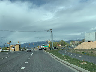 |
| US 89 reaches its first light in Davis County at Eagleridge Drive. This junction was reconfigured a bit in the early 2000s; originally this was the south end of Orchard Drive, which now goes through a roundabout just east of here. Orchard was a state highway at various points in the early to mid 20th century. |
 |
| Another u-turn for a second, because it's interesting - trucks are not allowed on NSL's Center Street, so in order to get to the industrial areas on the western side of the city trucks have to go all the way to I-15, take the 2300 North exit, head all the way out to Redwood, and backtrack. |
 |
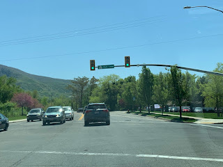
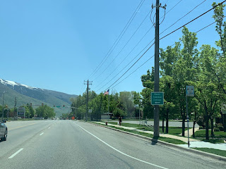
| US 89 runs along the Bountiful-North Salt Lake border for a few miles. This type of signage is what results when highways do that in Utah. |
 |
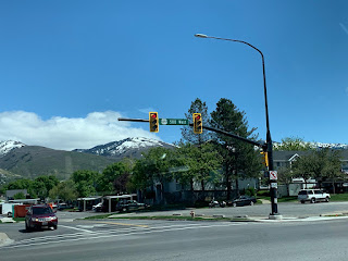
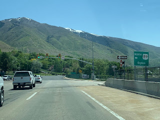
| Not far ahead, we will junction SR 93. |
 |
| Turn left on SR 93/2600 South to get to I-15. |
 |
SR 93 shield on the street blade. Three cities meet at this intersection - the near left corner is in North Salt Lake, the far left corner is in Woods Cross, and the right side is in Bountiful.
|
 |
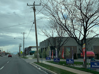
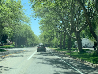
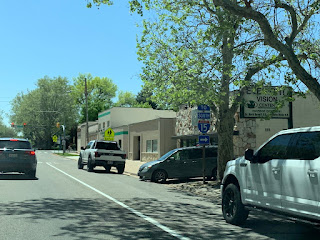
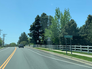
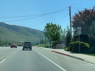
Technically, the Bountiful part of this highway is named "Main Street". This is almost never signed for a couple reasons, though, in order to not give the illusion that it currently connects to the part of Main through downtown. All other signage for the highway in this area simply labels it as "Highway 89".
|
 |
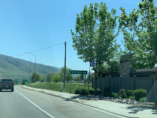
| Welcome to Bountiful (that's the only such sign I know of, by the way). SR 68 will exit off to the right. On the other side of that concrete barrier is Main Street. |
 |
| US 89 veers left onto 500 West, still following the Bountiful-Woods Cross boundary and onto the 1930s Bountiful bypass. |
 |
| This bridge was constructed in 1935 and I believe is the oldest grade separation on the Utah state highway system carrying a road over another road. |
 |
| In about another mile, we'll come to another junction with SR 68, this time at 500 South. |
 |
| Turn left for I-15 south, stay straight for I-15 north. Technically it may be faster to turn left here for 15 north, but that turn and the few blocks between here and I-15 to the west are not exactly fun during high traffic times. |
 |
| Either direction is SR 68. Stay straight for 89 north. |
 |
| Reassurance shield after that junction. From here on out, we either follow or closely approximate the West Bountiful-Bountiful boundary. |
 |
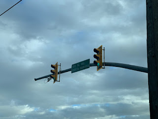
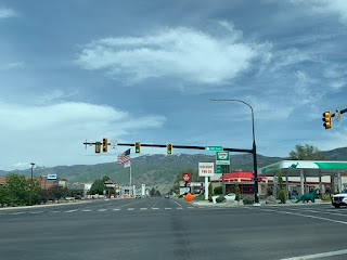
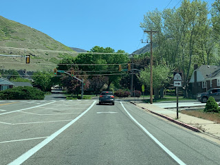
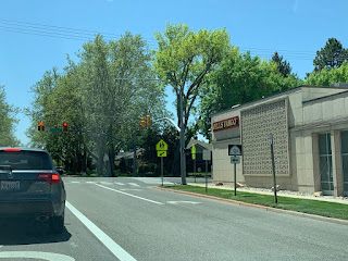
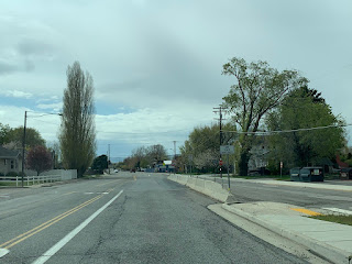
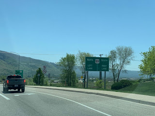
| 400 North another mile or so ahead is SR 106, which is not really signed from this direction aside from the street blade. |
 |
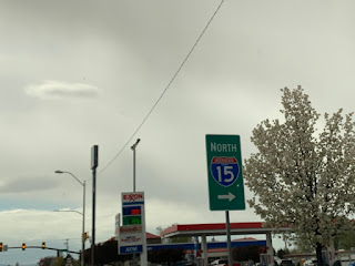
| More street blade signage for US 89 ahead at the 1000 North light. North of here, I-15 was built right on top of the 1930s US 89/91 bypass, and so US 89 will default onto that for a few miles. |
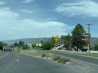
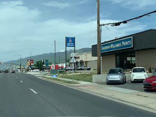
SR 106
Photos taken in either May 2020 (blue sky) or April 2020 (cloudy).
 |
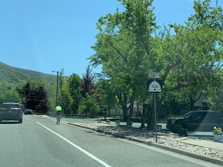
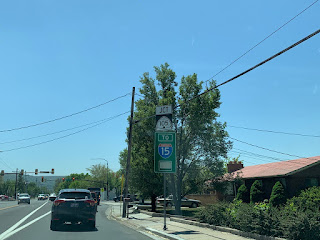
| We'll begin heading eastbound on Shepard Lane in Farmington from US 89. SR 106 begins. |
 |
| It isn't long before Shepard ends. 106 will turn right onto Main Street. |
 |
| Reassurance shield after that turn as we pick up old US 91. |
 |
| Park Lane is SR 225, which is not signed from this direction aside from the street blade. Turn right on that to get to a very messy interchange involving I-15, US 89, and SR 67. |
 |
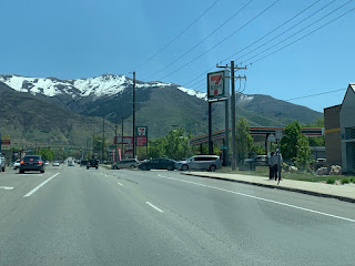
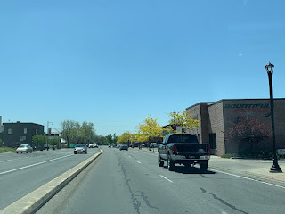
| 106 on Main Street in Farmington is a surprisingly pretty drive |
 |
| Turn right on State Street to get to I-15 south. It's also SR 227, but that for some reason is also not signed from this direction. |
 |
| SR 106 will turn left on State. |
 |
| Immediately after that turn, we'll veer right to stay on 106. |
 |
| Reassurance after navigating those turns as we curve onto 200 West. |
 |
| For some reason, part of 106 through southern Farmington is signed with a passing lane despite being a semi-suburban road with a 40 mph speed limit and a lot of traffic. Good luck ever using that. |
 |
| Continuing our southward journey, we enter Centerville and get another reassurance shield. |
 |
| True to its role as a historic highway, Main Street has Lincoln Highway markers scattered along it. |
 |
| In Centerville, we will junction SR 105, which also provides access to I-15. |
 |
| SR 105 begins to the right on Parrish Lane, which would otherwise be 400 North in the Centerville grid system. |
 |
| More street blade signage. |
 |
| 106 southbound reassurance as we head into "downtown" Centerville, which is much less of a historic district than Bountiful or Farmington |
 |
| It isn't signed, but at Pages Lane we cross from Centerville to Bountiful. |
 |
| Main Street is discontinuous at 400 North thanks to Bountiful's original downtown grid, so we'll do something original US 91 also did and curve to the west |
 |
This driveway could be used as a shortcut past the upcoming red light if you didn't read the sign.
|
 |
| Now heading solidly west on 400 North, we'll pass Main Street. That isn't anything today, but original US 91 and the Lincoln Highway made a left turn here. |
 |
| SR 106 reassurance after that light. |
 |
| We'll continue straight through the light at 200 West. Before 2001, 106 turned left here and SR 131 began ahead. |
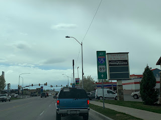 |
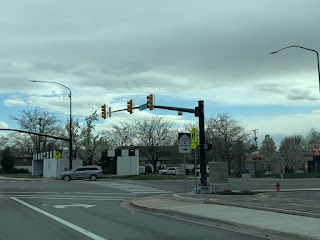
| This is a little misleading - although we do junction both of those routes, US 89 is the light in the distance and 15 is further out. |
 |
| Perhaps the reason it's mentioned is that due to incomplete interchanges, you have to turn right on 89 if you want I-15 north. |
 |
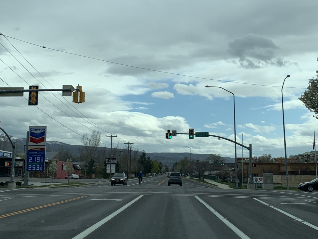
| Turn either direction on 500 West for US 89. Also check out the gas prices. |
 |
| Shields on street blades abound here. Note the two Chevrons on the far side, one at far left and one at far right. The one on the right used to be a Sinclair. |
 |
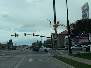
| One final reassurance after crossing US 89. |
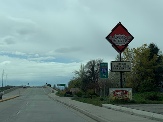 |
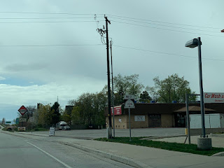
| We'll pass the Ramblin' Roads Diner with its US shield logo. I-15 is ahead. |
 |
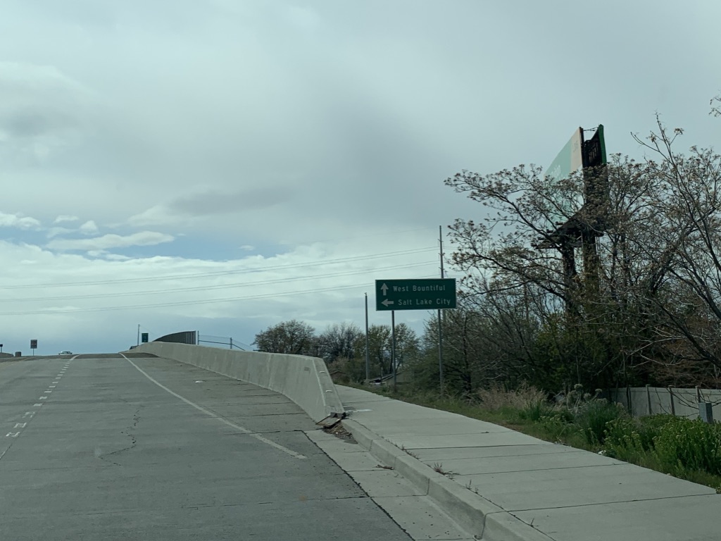
| Stay straight for West Bountiful. Turn left for Salt Lake City. |
 |
| Turn left for a ramp to southbound I-15. |
 |
| Welcome to West Bountiful! Technically, we've been in it ever since we crossed 89, but most people think of it as just the part west of the interstate. |
 |
| SR 106 ends at the bottom of the bridge approach. The intersection ahead is Onion Street. |
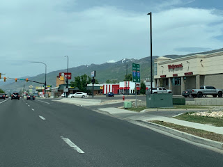
SR 273
Photos taken in May 2020.
 |
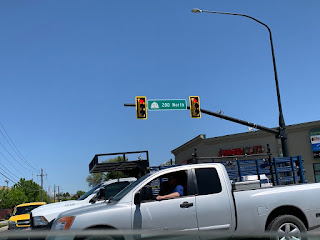
| As we head east on 200 North in Kaysville under I-15, SR 273 begins. |
 |
| Our first reassurance shield, oddly without a direction. Perhaps because we're heading compass east, but 273 is largely a north-south route. |
 |
| This highway has one of those fancy new UDOT street signs with the route shield. |
 |
| Turn right for a bunch of food, camping, and the Davis Technical College. |
 |
| Also turn right to stay on SR 273. |
 |
| No reassurance after that turn, unless it's behind the truck. |
 |
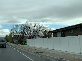
| 273 heads south on Main Street through historic downtown Kaysville. This is historic US 91 and the original Lincoln Highway. |
 |
| Another fancy new UDOT street blade, this one at the intersection with 50 West. |
 |
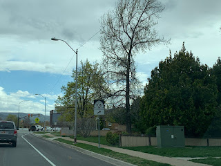
| 273 heads southeast down Main Street towards Farmington. Turn left ahead for the Davis Technical College. |
 |
| Fittingly, turn on Davis Tech Drive to get to Davis Tech. |
 |
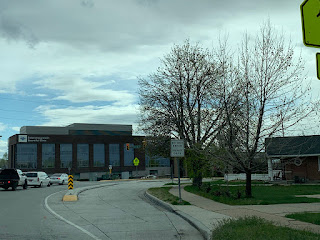
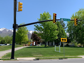
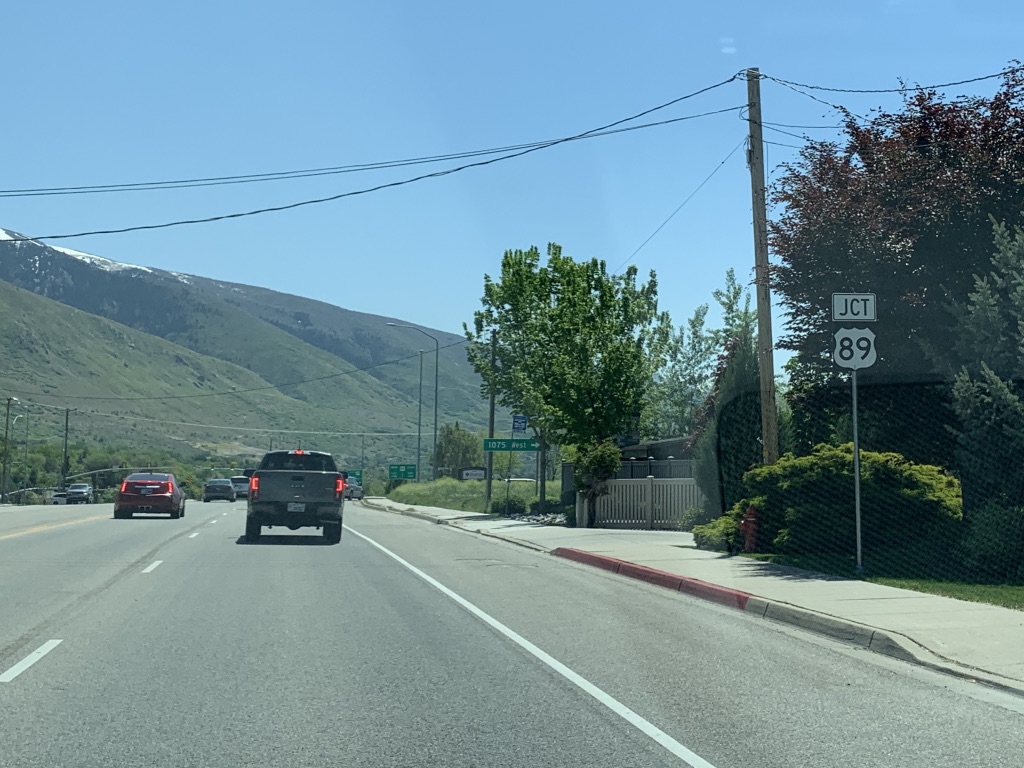
| After running along the Kaysville-Fruit Heights border for a bit, we'll come to a junction with US 89. |
 |
| But first, turn right for 1075 West. We'll enter Farmington proper after that intersection. |
 |
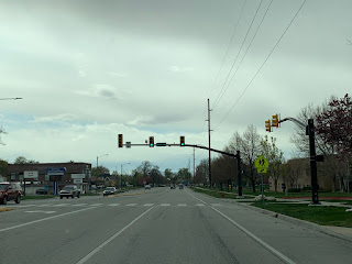
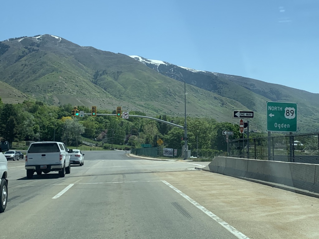
| Stay in the left lane for US 89 north; right lane for 89 south. |
 |
| 89 heads north from here to Ogden and south to Salt Lake City. |
 |
| Although old US 89/91 continues ahead along Main Street into Farmington, SR 273 ends here. |


No comments:
Post a Comment