For this post, we'll head east to a more rural part of Utah and look at the highways that have served much of the northwestern Uinta Basin and northern Duchesne County. Today, there is pretty much just one state route in that area - SR 87 - but that was pieced together from a rather messy route network that once covered quite a bit more mileage.
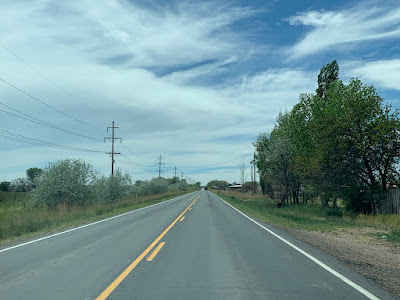 |
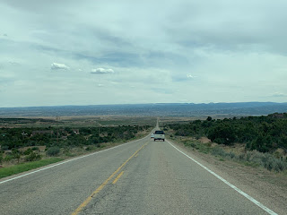
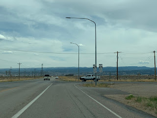
SR 87 today west of Ioka Junction, through a typical landscape of this area.
|
This is a mostly flat, agricultural area that primarily centers on the Lake Fork River and its immediate tributaries. It is also fairly isolated, so it was not served by any state highways for many years. The main east-west highway through this part of the state (SR 6 and later US 40) passed south of this region. The area's first state highway, SR 134, was defined in 1933:
(134) From Neola westerly to Altonah.
This route began at the right angle in SR 121 at Neola. It looks to have proceeded generally southwest on 9000 North, 4000 West, 8500 North, and 6000 West to Monarch, then generally west on 8000 North, 7000 West, Boulder Boulevard, and 7000 North to Altonah.
It seems rather odd that the first numbered route in this area would have come from the east, over much hillier and sparser terrain than the areas to the south and southeast. But it wasn't the only route for long. In 1935, the state legislature also defined SR 86 and SR 87 in the area:
Route 86. From Altonah on route 134 via Mt. Emmons and Upalco to Bridgeland on route 6.
Route 87. From Upalco on route 86 to Ioka.
The "Ioka" end of 87 almost certainly referred not to the settlement of Ioka, but rather to Ioka Junction on US 40/SR 6, and future legal descriptions clarified this. Interestingly, 87 was explicitly called out as a federal aid project. 86 and 87 first appeared on the official Utah highway map in 1937. Even though 134 was defined first, it didn't appear until the next year's map. Here is a screenshot from that:
 |
| USRC/Gousha, 1938. |
Back then, US 40 did not run on its modern route from Duchesne to Myton, but on East River Road, sandwiched between the mesa known as Blue Bench to the north and the Duchesne River to the south. Bridgeland was where that alignment crossed the Duchesne River about halfway between Duchesne and Myton, and that is where SR 86 started. 86 went around the east end of Blue Bench and then north on 12000 West, up the Ravola Dugway onto the North Myton Bench, then north to Upalco. (Note that the Ravola Dugway is now a private driveway and it no longer has a bridge over the Lake Fork River - a more direct way up was built in 2008.)
Beyond Upalco, the map above suggests 86 went through Bluebell and not Mount Emmons. That is likely wrong - based on the legal description and other maps, it appears 86 turned northwest a bit south of where the modern SR 87 does. It followed 13500 West and 14000 West north and 3000 North west to Mt. Emmons, then through the settlement on 14800 West and 3210 North. From there, it went north on 15000 West and west on 4000 North to the modern site of Altamont, then north on 16000 West to Altonah. It ended there probably at the intersection with 7000 North (SR 134) - yes, likely at the same intersection 134 ended.
Notice, by the way, that there was just about no pavement in this area off of US 40. Only SR 87 from Ioka to 40 was even improved gravel. Everything else was some flavor of gravel or dirt road. That would be the norm for years to come.
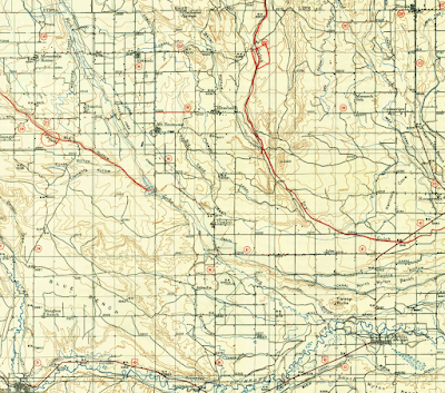
Messy, right? Here is a 1939 USGS topo that hopefully illustrates some of this:
 |
| USGS (Duchesne), 1939. |
Interestingly, that map has the east-west SR 87 on Pole Line Road (2000 South) rather than Ioka Lane (3000 South) a mile to the south. The 1940 census enumeration district maps had it on Ioka Lane, all legal descriptions for 87 and other maps were pretty specific about the route passing through Ioka, and the next USGS map had it on Ioka Lane... so I'm going to say that is a typo (or mapo, I guess).
It's also interesting that map still has SR 134 - because in 1939, SR 134 was deleted as a state route. However, the 134 number was immediately reassigned to another set of roads in the general vicinity:
From junction of route 35 six miles north of Duchesne northerly to a point one mile north of Mountain Home; also from junction of 86 at Altamont westerly to connection with Duchesne-Mountain Home road.
This was essentially a two-component route. The main component was the north-south route beginning at 35, passing the community of Talmage to the east, and running north through Mountain Home on 12000 West. Based on the road network in the area, the northern terminus was probably at the intersection of 12000 West and 7500 North, even though this is not exactly a mile north of Mountain Home.
The other component was an east-west connector between the north-south route defined above and SR 86 at Altamont. That primarily ran along 3750 North and 4000 North, as SR 87 does today, but it passed directly through Boneta on 18750 West, 4000 North, and 18000 West. Per the 1940 Census maps, no southern bypass of Boneta existed yet:
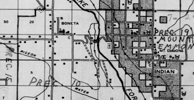 |
| US Census, 1940. |
In 1941, to get rid of the split-route nature of SR 134, that east-west branch was renumbered SR 221. The same year, the northern end of 134 was extended north to the boundary line of the Uintah Indian Reservation. This probably followed what is now 7500 North, and 20800 West. It's a little unclear, but it looks like that boundary line is where 20800 West crosses the road Google labels "20780" but should really be 8000 North.
Two years later, the legislature defined a new SR 199, running directly east from Altamont along 4000 North/Bluebell Road to Bluebell. And then two years after that, in 1945, the road from Altonah to Neola (which had been SR 134 before it was deleted in 1939) was added back to the state system... but as SR 237 this time. Again, it shared a terminus at Altonah with SR 86.
As we've already noticed, the mapping in a lot of northeastern Utah during this time was often times somewhere between unclear and wrong. Here is the state map in 1945:
 |
| USRC, 1945. |
The new SR 134 and 221 were clearly visible. However, no 199 or 237... though in 199's case, the road may not have actually been built yet. The original road to Bluebell departed 86 from Mt. Emmons, and that is what's shown on the map above. The SR 199 description stipulated that it began at "route 86 east of Altamont", which is definitely not Mt Emmons and is almost certainly the intersection of 15000 West and 4000 North.
One might also notice Altamont is missing from the map. Why is that? Turns out, Altamont is actually a fairly new town. It grew around a high school that was built in 1935, intended to serve both Altonah and Mount Emmons (the name is a portmanteau of sorts of those two settlements). Altamont would incorporate in 1953.
At any rate, Altamont is on that east-west road (4000 North), located exactly halfway between the road north to Altonah and the road south to Mt. Emmons (that is, almost right underneath the "2" on the map). The right angle visible in 86 indicates that the new Altamont-Bluebell road probably wasn't done yet. Perhaps 199 was signed along the existing Mt Emmons-Bluebell road (3000 North, a road northeastward down the cliffs that doesn't exist anymore, and 4000 North) until this new connection could be built.
By this time, all of SR 86 and 87 had been improved to gravel, but all other routes in the area were still dirt surfaced.
In 1947, the legislature extended SR 199 further east from Bluebell, to SR 121 northwest of Roosevelt. The same year, SR 237 was decommissioned. (yes, 4 years after it was created and 8 years after it was deleted the first time. Make up your mind, UDOT!)
Here is what that year's map looked like:
 |
| USRC, 1947. |
Again no 237, and now it was gone for good - so that route never appeared on an official Utah map. The eastward extension of 199 to 121 was shown, and it was shown as a dirt road pretty much straight east from Bluebell through Cedarview. That suggests a route directly east from Bluebell on 4000 North all the way to 121.
The 1949 USGS topo of the area, however, is a fascinating look:
 |
| USGS (Duchesne), 1949. |
That map did show 237, two years after it had been decommissioned. That's not unusual for USGS maps, but what's far more interesting here is what they did with 199. This is technically the 1949 edition of a 1939 map, meaning the basemap with the roads was made in 1939, and then edits were made to account for ten years' worth of changes. Often times those edits are in a different color and so usually stand out.
Per this map, by then SR 221 had been moved to bypass Boneta on 4000 North, and SR 86 had been mostly moved to the location of the modern highway south of Mt. Emmons, with most of the stair-stepping along section lines eliminated. The only place that was still an older alignment than today's highway was the area around Big Sand Wash Reservoir.
SR 199 was shown on the map as a solid red line for the first two miles east of 86, indicating that it was a new road since 1939 (or maybe it was under construction by this time). However, no connection road was indicated on UDOT maps until the 1960s. Seems likely to me to be an issue of bad cartography on UDOT's part than anything else. But east of Bluebell, the road simply ends. Another 199 segment is shown along 4000 North, through Cedarview and junctioning SR 121. No connection existed between the two 199 segments, so this was probably an instance of a legislated-but-never-built road. The eastern segment of 199 probably began at 6000 West, or three miles west of Cedarview, and extended east four miles to SR 121.
In 1953, probably in recognition that no road actually existed between Bluebell and Cedarview, all of SR 199 east of Bluebell was removed from the state highway system. In its place, 199 was extended south from Bluebell along 12000 West to a new southern terminus at SR 86, just north of Upalco.
Below is a portion of the 1964 official Utah map:
 |
| USRC/Rand McNally, 1964. |
That showed the change in 199 to send it south of Bluebell, and it had the Boneta bypass on 221...but it also still had the original alignment of 86 between Upalco and Mt. Emmons. However, we know from aerial imagery that the modern route was intact by then, and USGS maps put the highway on the new road, so I'm inclined to think the state just never updated their maps of that area. Also, the intersection at the top of the Ravola Dugway where SR 86 and 87 met was in its final configuration now. Furthermore, by this time, almost all of the state routes in this area had finally been paved. The exceptions per the map were the segment of SR 86 north of Altamont and a small part of SR 199, which remained gravel.
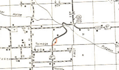
Another realignment too small to see on that map occurred near the junction of SR 134 and SR 35, which wound up shifted to the east-southeast around 650 feet. This occurred probably at the same time as a new highway was built out of the north side of Duchesne, and based on the completion date of the bridge over the Duchesne River, this was likely done around 1959 or 1960. (I'll do a future post on SR 35 that should discuss the history of the highway north and west from Duchesne.) There was also a small 134 realignment near Talmage that was completed in 1955, though the state retained ownership of the right-of-way until 1971, when this map was made:
 |
| USDH, 1971. |
What is visible on the 1964 state map above, however, is the slight southward extension of SR 86. In 1962, US 40 was moved to a new alignment south of the Duchesne River between Duchesne and Myton, bypassing Bridgeland. The map above shows 86 extended southwest from Bridgeland to the new alignment. There is no bridge there today...and there wasn't then, either. The map is wrong. Looking at the actual commission resolution that moved the routes, 86 was extended east on the old 40 alignment to the point where it met the new bypass.
 |
| USDH, 1962. |
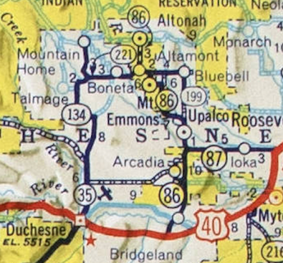
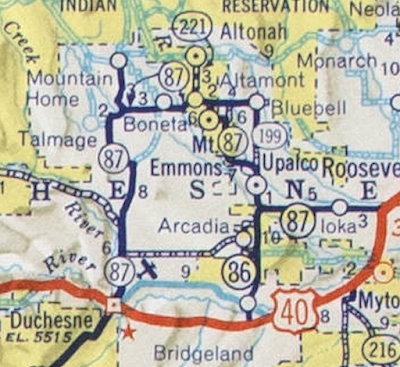
Almost the entire route network in this area was renumbered in 1964. The big thing here was a major westward extension of SR 87, which previously only extended from the Ravola Dugway (south of Upalco) east to Ioka Junction. 87 was extended north over SR 86 through Upalco and Mt Emmons through Altamont, then over SR 221 west to a point south of Mountain Home, then over SR 134 south to its junction with SR 35 north of Duchesne, then south over SR 35 itself to the US 40 junction in Duchesne.
All of those other routes got truncated, mostly becoming short spurs. The east end of SR 35 was truncated to its junction with SR 87 about six miles north of Duchesne. 134 was reduced to about four miles of roadway, from SR 87 north through Mountain Home to the reservation grazing land boundary. Since 87 absorbed a portion of 86, to avoid a concurrency, the road from Altamont to Altonah was renumbered to SR 221, which had just been entirely absorbed by the 87 extension. (So is that technically two SR 221s? Hm.) SR 86 became simply the north-south connection between US 40 near Bridgeland and SR 87 south of Upalco.
So basically, the outcome of this renumbering was a long loop off US 40 between Duchesne and Ioka Junction, designated 87, with roads branching off of it towards Tabiona and onward (35), Mountain Home (134), Altonah (221), and Bridgeland (86), as well as a loop through Bluebell (199). Those were shown on the next year's map:
 |
| USRC/Rand McNally, 1965. |
In 1965, SR 199 was realigned slightly north of Upalco due to the construction of Big Sand Wash Dam and the subsequent flooding of part of the route from the associated reservoir. The following map from the commission resolution illustrates this, and also confirms the existence of the modern route through Mt. Emmons, despite what the full state maps continued to indicate at this time.
 |
| USDH, 1965. |
However, just four years later in 1969, SR 199 was deleted from the state highway system along with SR 86, 134, and 221 in the largest single-year state highway dump Utah has ever done.
There haven't been any big picture shifts in the highway network in the area since then, but there have been some smaller changes. As part of the Big Sand Wash dam and reservoir project, the state had created Big Sand State Park and intended to develop it. So in 1972, the state road commission added a proposed access road connecting the park's boat ramp to 12000 West as SR 305, shown in the map below:
 |
| USDH, 1972. |
But that road was never built. A new road to the boat ramp was built by 1985, but it wasn't really that close to what was in that map, and it seems nobody considered what was built to even be a realignment. According to the highway resolution documents, Transportation Planning deleted SR 305 sometime between 1988 and 1990 because "it was found there was no way to inventory said route" - presumably because the road didn't exist. The legislature formally decommissioned 305 in 1990.
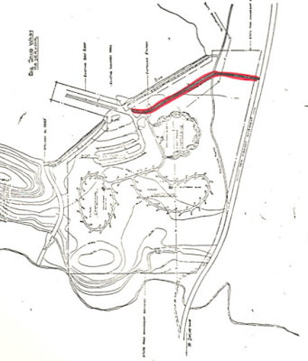
More recently, Ioka Junction (east end of SR 87 at US 40) has been slightly adjusted. Since the earliest days of the state highway system, it had been a skewed intersection:
 |
| Google Earth, 2006. |
In 2009, the east end of 87 was realigned to intersect US 40/191 at a much safer 90-degree angle. The area of former 87 pavement is still vacant right-of-way owned by UDOT, and it is pretty obvious even from the ground today that it used to be a road.
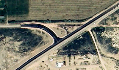 |
| Google Earth, 2009. |
Route Photos
SR 87
We'll start heading north from Duchesne. These photos were all taken March 2020:
 |
| Initial reassurance shield heading north from US 40/191 in Duchesne. |
 |
| The town of Altamont and recreation sites of Yellowstone Canyon (different Yellowstone), Moon Lake, and Upper Stillwater Reservoir all lie ahead. |
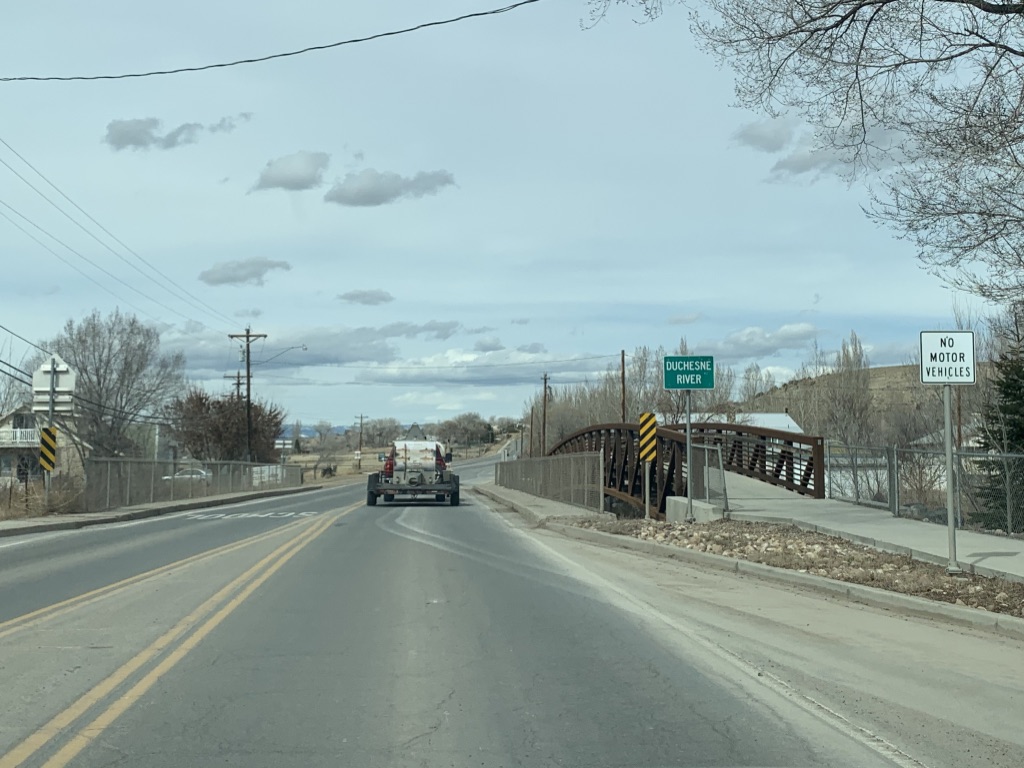
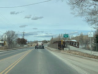 |
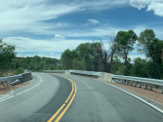
| SR 87 will cross the Duchesne River. |
 |
| Not all that much water in the river, and even some snow on the bank. Clearly, runoff season has not started yet. |
 |
| Turn right for the Duchesne County Justice Center - a nice euphemism for the county jail and courthouse. |
 |
| Not far ahead, we'll pass the turnoff for the Duchesne Airport. |
 |
| As we straighten out to the north, the Uinta Mountains will come into view. |
 |
| Coming up is the junction with SR 35. |
 |
| Turn left for Tabiona. |
 |
| 87 continues ahead, while 35 begins to the left. Originally, the road between Duchesne and here was a part of SR 35. |
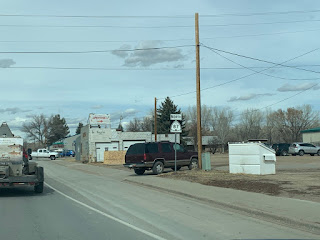
Now, we'll proceed the other direction, starting at Ioka Junction at US 40. These were taken June 2020:
 |
| This used to be the beginning of SR 87, before the junction was realigned slightly to the west. |
 |
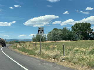
| Reassurance marker after the actual beginning of the route. |
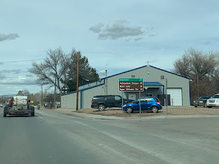
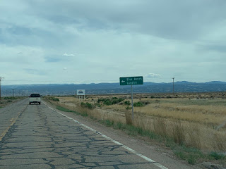
 |
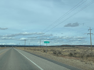
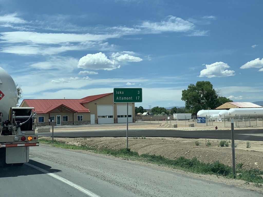
| Ioka and Altamont lie ahead. |
 |
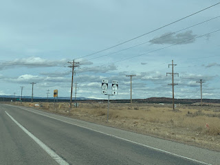
| Use 87 for Yellowstone Canyon, Moon Lake, and Upper Stillwater Reservoir. All three are located in the southern Uinta Mountains. |
 |
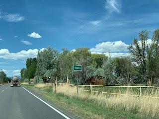
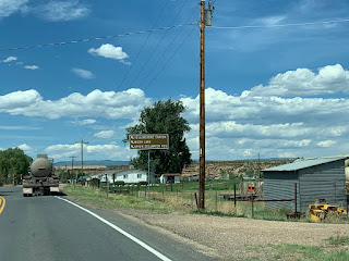
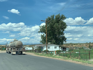
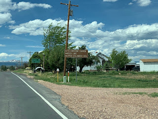
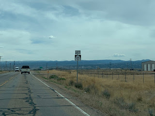
| This decorative sign welcomes us to the Upalco area, though the actual settlement isn't for a few more miles |
 |
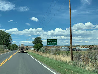
| Stay straight for Altamont. Turn left for the functional equivalent of old SR 86 south to Bridgeland. |
 |
| Reassurance shield after that intersection, as we move onto the road that was originally SR 86 |
 |
| Continue on to Big Sand Wash Reservoir and the towns of Bluebell and Altamont. |
 |
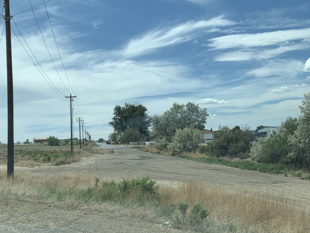
| Welcome to actual Upalco. |
 |
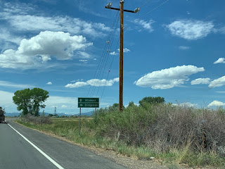
| Stick left for 87 to Mt Emmons and Altamont. Turn right for a county road to Bluebell. |
 |
| The three Uintas recreation areas are all up 87. Though it didn't make the sign, Big Sand Wash State Park is to the right. |
 |
| The road to Bluebell used to be SR 199, and is now Duchesne CR 137 |
 |
| 87 tracks through some marshy areas as we cross Big Sand Wash. |
 |
| As we continue moving northwest, the Uinta Mountains come into view |
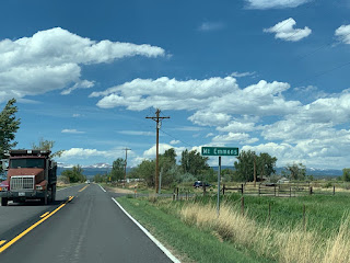 |
| Entering Mt. Emmons. |
 |
| Veer left ahead to stay on 87 to the same three Uintas recreation areas. |
 |
| Turn right for the other end of old SR 199 to Bluebell, or stay left for 87 to Duchesne. You'd think Altamont would have been a better control city for here. |
 |
| Shortly thereafter, sure enough we'll enter Altamont |
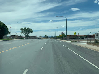 |
| SR 87 is a four-lane highway through Altamont, which is surprising considering its relatively low population and that it is not really on a major through route |
 |
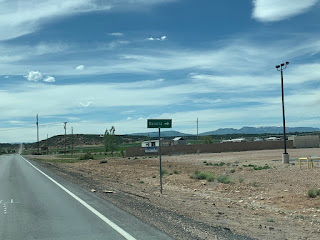
| Altonah is three miles to the right. That road was SR 221 before 1969, and SR 86 before 1964. |
 |
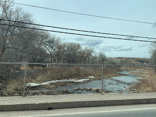
| Moving west, we'll drop down into a wide canyon to cross the Lake Fork River |
 |
| The bridge at the bottom. The Lake Fork River is one of several significant streams draining the south side of the Uinta Mountains |
 |
| Boneta is about a half mile to the right. This east-west highway used to go through Boneta but now bypasses it to the south. |
 |
| It comes close enough that they have a decorative sign on here, though |
 |
| This east-west highway was SR 221 before 1964. |
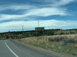 |
| Turn right for Mountain Home and Rock Creek. That turn is old SR 134 |
 |
| Those three Uintas recreation areas we keep seeing signs for...are finally up that way |
 |
| A small hill follows that junction as we turn south. We're west enough that we are starting to get into Uinta foothills territory. |
 |
| SR 87 reassurance at the top of the hill. |
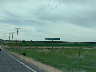 |
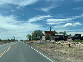
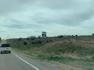
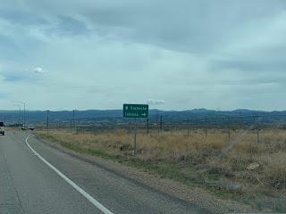
| Talmage isn't far to the right. |
 |
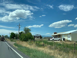
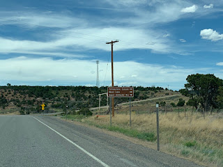
| The sign says there is food, phone, gas, diesel, lodging, and camping in a half mile. It lies. Whatever rest area used to be there is closed. |
 |
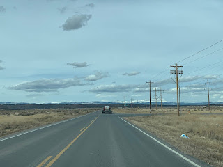
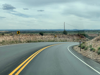
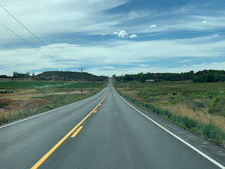
| SR 87 heads south down the hill towards Duchesne, with the Wasatch Plateau and Tavaputs Plateau in the background. This north-south segment of road used to be 134. |
 |
| The Blue Bench Landfill is to the left. Presumably that serves most of Duchesne County. |
 |
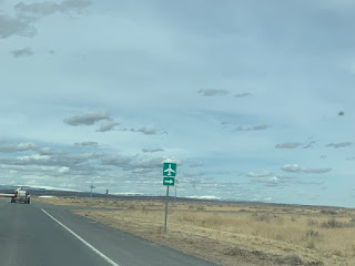
| SR 35 junction ahead. |
 |
| Stay straight for 87 to Duchesne, or turn for 35 to Tabiona. |
 |
| SR 35 begins to the right. |


No comments:
Post a Comment