Today, we'll return to southwest Utah but continue the theme of mountain roads, discussing the east-west state routes that have crossed the mountains to connect I-15/US 91 and US 89 through the years. Specifically, this post will focus on the routes that have made this connection between roughly Beaver and Parowan.
Looking at a terrain map, this area is ideal for a connection between 15 and 89 because although a continuous mountain chain still separates the two routes, this region is right between the high Tushars to the north and the Markagunt Plateau to the south, and so it provides an opportunity to cross the mountains at a much lower elevation. Case in point: the modern SR 20 has a summit elevation of 7900 feet, whereas the next state route crossings to the north and south (153 and 143 respectively) both reach well over 10,000 feet.
 |
| Source: topographic-map.com. |
There has been more than one route number across these mountains through the years, and they've gone through a rather complicated history of realignments that weren't described all that well - so they were surprisingly difficult to research. Complicating the matter is the location of "Spry" in relation to other named places in the area ...
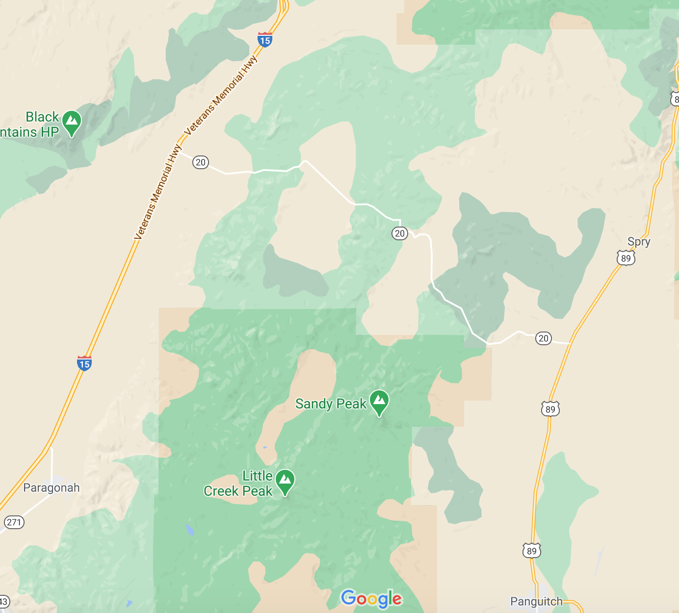
The east end of SR 20 at US 89 is usually known as Bear Valley Junction now, but was historically referred to as Orton (and is still defined that way in state law). That intersection is located about 10 miles north of Panguitch. In addition, according to historian John W. Van Cott, a place called Spry is located 8 miles north of Panguitch. Unfortunately, Spry is not really a visible community any more, so it's a bit difficult to identify where it was exactly...but there is a Spry Cemetery, located just off US 89 about 7 miles north of Panguitch. That goes along well with Van Cott's description.
So Spry should be located about 7-8 miles north of Panguitch where the cemetery is, and Orton/Bear Valley Junction a few miles beyond that. We'll look at a few historic maps later on in this post that confirm that understanding. But here's a screenshot of the modern Google Map of the area:
 |
| Google Maps, January 2021. |
Google actually switches the order of Orton and Spry. Instead of putting Spry a few miles south of Orton Junction, they have it several miles to the north!
I would completely dismiss that and knock Google for being Google here, but in this case the location comes straight from the USGS's Geographic Names Information System (GNIS) - usually a more reliable resource. And to make matters more confusing, if we go back to Van Cott's write-up on Spry, he says that "Orton" was an old name for Spry that was used for a time (it was renamed Spry by the local postmaster in 1908). So another possibility is that Orton and Spry were two names for the same place, and the Orton name was brought back at some point specifically to refer to the highway junction.
Now that we've gotten that out of the way, let's go back to talking about state highways. In 1917 and 1918, a road was built between Paragonah and Orton as part of Federal Aid Project #21 and added to the state system. It was not one of the designated 1919 state highway corridors, which normally would have resulted in its deletion that year...but since it had been built with federal aid, it was retained on the state system. In 1927, it was assigned the SR 20 designation:
20. From Paragoonah easterly to Orton, Garfield county.
And here it is on the official 1933 state map:
 |
| USRC/Gousha, 1933. |
A couple things to note here. One is, of course, that Spry is shown 7 miles north of Panguitch and 3 south of Orton. The other is that the majority of this version of SR 20 does not follow the modern corridor. The westernmost 3/4 of original SR 20 ran along roads that aren't state highways anymore. Instead, it followed a road now signed as Little Creek Road - but depending on what online mapping site you're using, parts of it may also be labeled as Little Creek Canyon Road, Upper Bear Valley Road, or Forest Road 077.
That map wasn't explicitly clear on how 20 ended in Paragonah - did it end at US 91 a mile north of the town center, or did it make some sort of connection on local streets and terminate directly in the middle of town? Luckily, we have 1940 census maps to answer this question, and it appears the former possibility is the correct one:
 |
| US Census, 1940. |
This is only interesting because normally, this sort of ending in state law would be worded as "north of Paragonah". So there might be a slim possibility that very early on, it may have turned south on that unimproved road and then entered Paragonah on 300 East and Center Street (although based on the quality of that left turn today, seems rather unlikely).
A few years before that map was made, the state designated a new SR 90, which was built a few years later. It acted as a northern branch of SR 20, connecting to US 91 about halfway between Paragonah and Beaver:
Route 90. From a point on route 1 near the north line of Iron County southeasterly to junction with route 20.
That northern branch is exactly the route of modern SR 20. So beginning in 1935, the entirety of what is now SR 20 was on the state system, but not all of it was under that designation yet.
 |
| USRC, 1941. |
Notice that Spry is not on this map, and that the new SR 90 was labeled "primitive road". Perhaps that is why in 1943, SR 90 was redefined to extend to US 89 as follows:
Route 90. From a point on route 1 (U.S. 91) in Iron County near Beaver County line southeasterly to state road No. 11 (U.S. 89) at Spry in Garfield County (19 miles).
SR 20 was not redefined at the same time. If we assume Spry to be located between Orton and Panguitch (consistent with the maps above and where the town cemetery is now), then this change would have put the eastern half of 90 on a proposed-but-never-built road, with 90 and 20 crossing somewhere in the mountains.
But if we use the northern, GNIS location for Spry, it opens up another possibility for 90: the roads leading southeast from what's now I-15 exit 100 - Freemont Road and Dog Valley Road - provide a connection that matches every aspect of that description, even down to the mileage. According to Google Maps, those roads combined add to 19.4 miles.
So which is it? Let's have a look at the 1945 state map:
 |
| USRC, 1945. |
So that means our second possibility was the right one. In 1943, SR 90 was completely picked up and moved to a totally different corridor about 5 miles to the north. The map labeled "Spry Junction" (not Spry) as the east end of SR 90, north of Orton Junction.
But that only lasted four years: in 1947, SR 90 was decommissioned entirely. SR 20 probably assumed its present form at that time, with the road to Paragonah being abandoned in favor of the road northwest to US 91, along what had previously been SR 90 (which probably had been upgraded beyond the "primitive road" shown in the 1941 map. What is strange is that the legislative description for 20 was never updated. But according to Shell's Utah highway map, SR 20 existed in its present form by 1950:
 |
| Shell/Gousha (Utah), 1950. |
However, the SR 20 description continued to indicate a western terminus in Paragonah before finally being updated in 1953. Since then, other than the conversion of its western terminus at US 91 to an I-15 interchange, the route has not changed.
Route Photos
SR 20
 |
| We'll start at I-15 and cross a cattle guard as we begin our journey over the mountains |
 |
| US 89 is 20 miles ahead. Those three other cities are all on 89, illustrating that the main purpose of this route is to connect there |
 |
| Several state and national parks in this area. Most people are probably on this for Bryce. |
 |
| Visible at left is a downhill runaway truck ramp. Interestingly, this one relies on deep gravel instead of elevation to slow down trucks |
 |
| Watch out for ATVs, apparently |
 |
| Reassurance shield, finally |
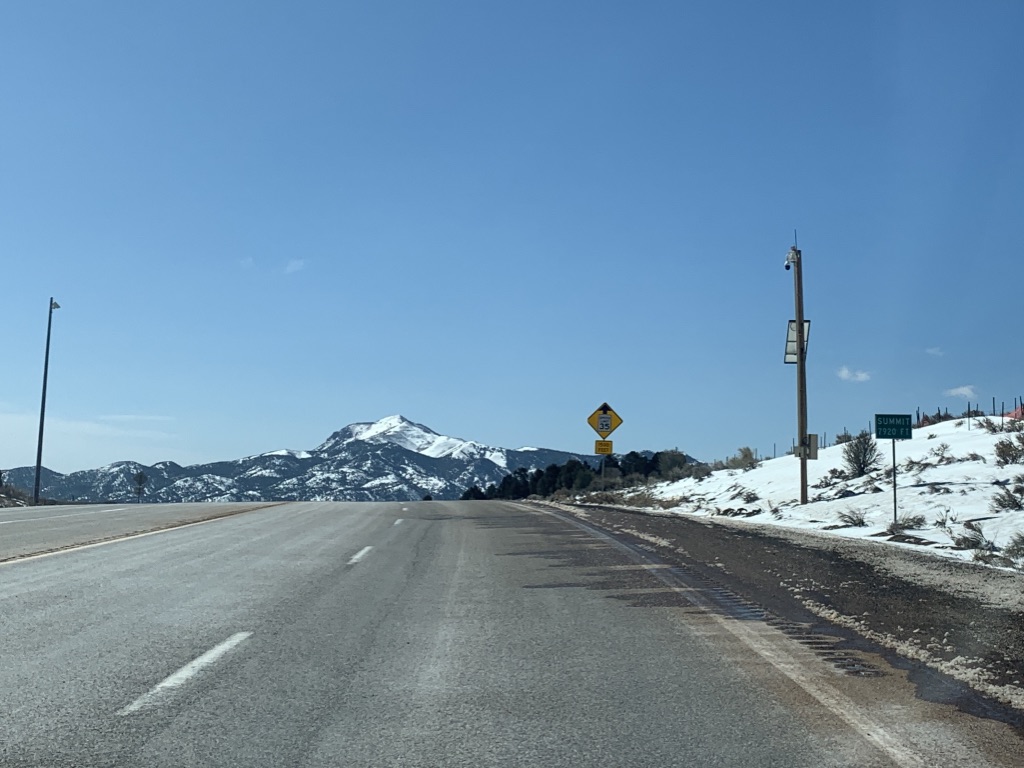 |
| The 7920-foot mountain pass separates the watersheds of the Beaver from the Sevier River. |
 |
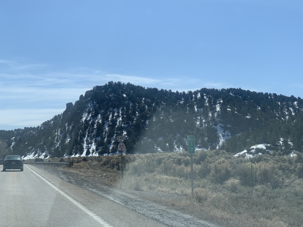
| The peaks ahead of us I think are part of the Markagunt Plateau. |
 |
| We'll intersect the route of the Old Spanish Trail, which follows the original SR 20 to Parowan. |
 |
| Reassurance shield after that junction |
 |
| Another reassurance marker |
 |
| Entering Garfield County, though now we're within a few miles of the end |
 |
| It isn't long before we reach the junction with US 89. |
 |
| Turn left for Circleville, right for Panguitch and Kanab |
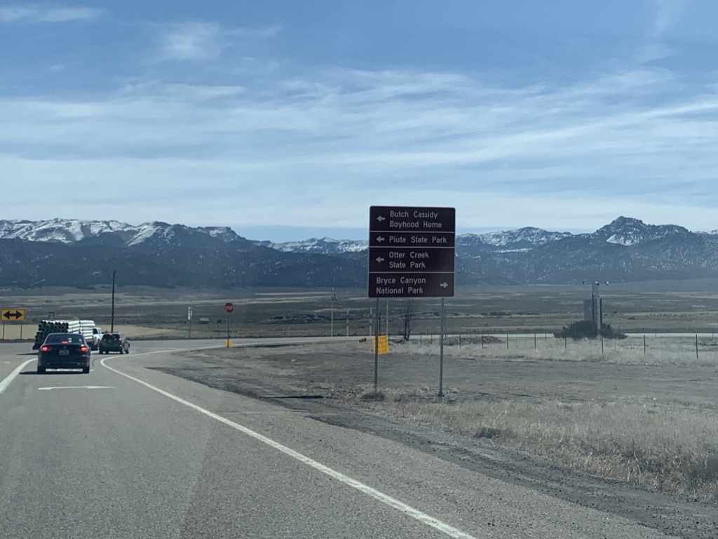 |
| Butch Cassidy's Boyhood Home got top billing on a sign with Bryce Canyon National Park and some other state parks. Hm... |
 |
| SR 20 ends. |


